

Black Hills Back Country Byway | Arizona
Embark on a 21-mile journey through the rugged heart of the Old West along the Black Hills Back Country Byway. As you travel, imagine the grit and spirit of the pioneers who once carved their way through this untamed land. They lived close to nature, faced formidable challenges, and helped shape the legacy of the American frontier.
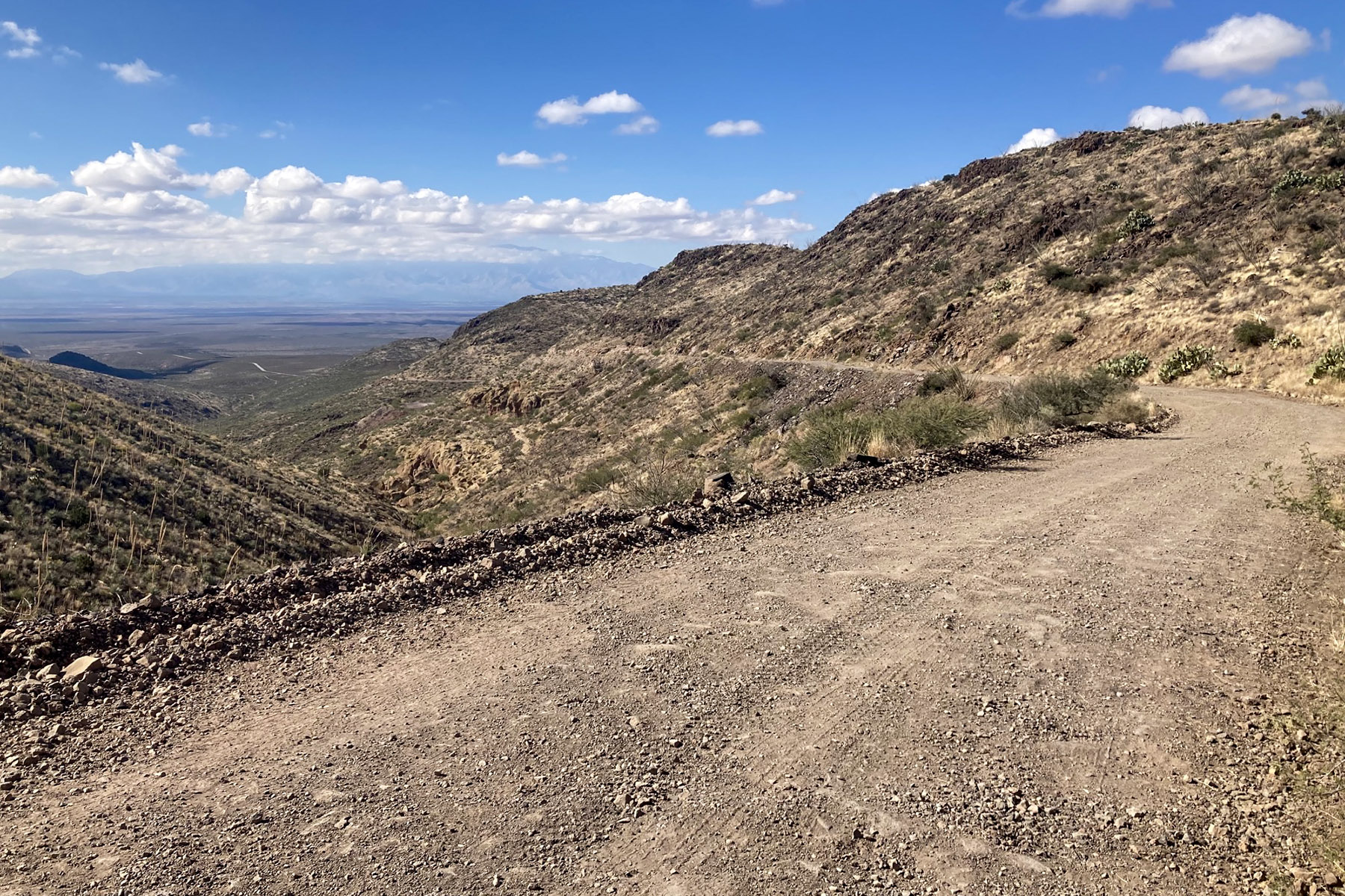
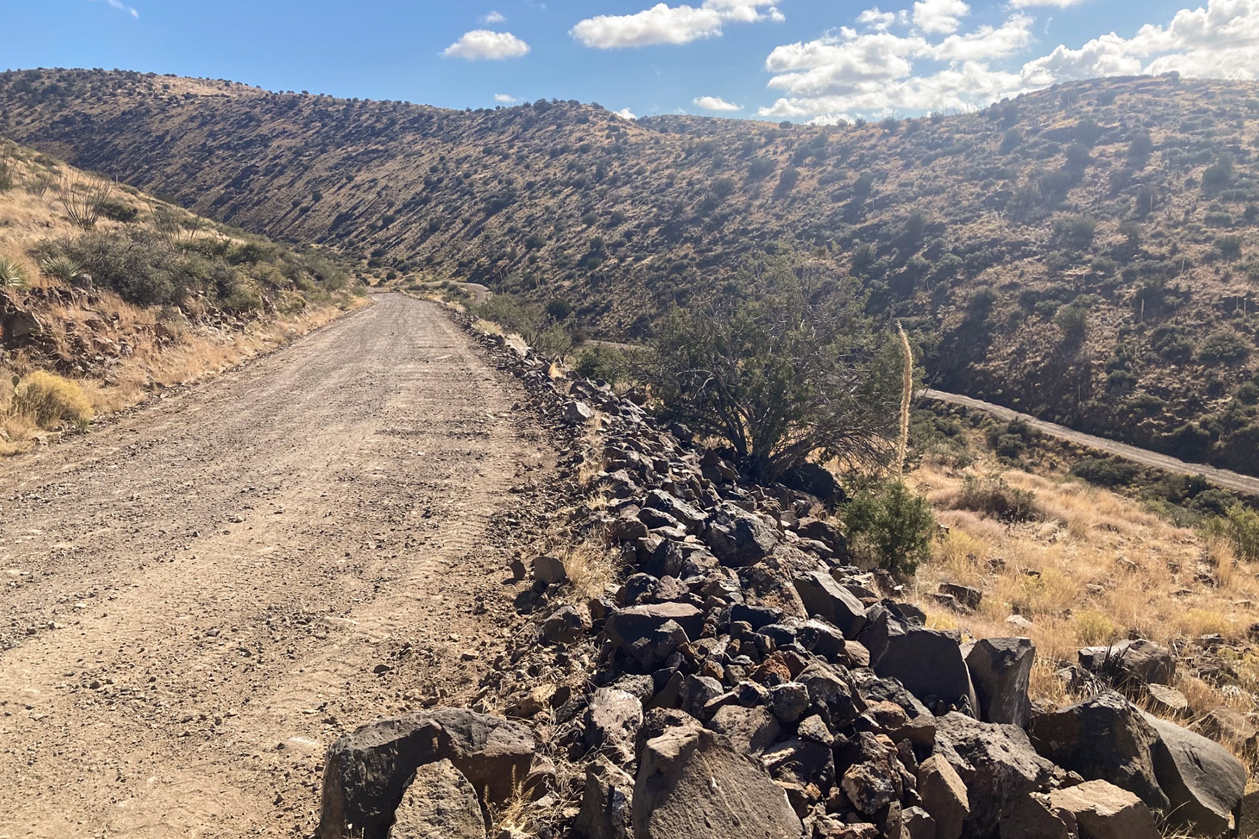
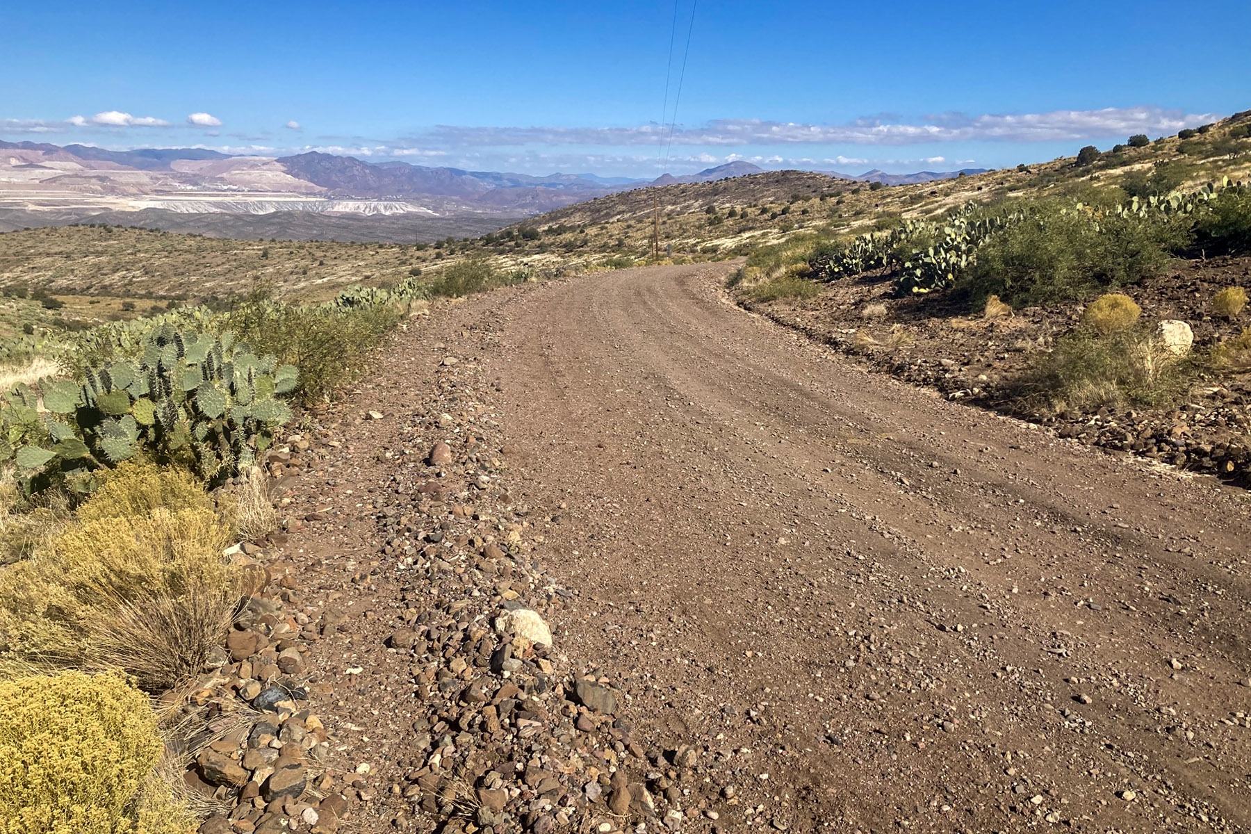
Today, you can follow in their footsteps. This is a Type II byway, designed for high-clearance vehicles. The road is unpaved, made mostly of native soil with stretches of gravel surfacing. While it’s rugged, it’s navigable with a two-wheel drive high-clearance vehicle — no extreme gear required.
Primitive side roads offer exciting terrain for off-highway vehicles and experienced mountain bikers. History buffs will uncover remnants of old mining operations and 1930s erosion control projects by the Civilian Conservation Corps.
Rockhounds can head to the nearby Black Hills Rockhound Area to hunt for fire agates, while unique rock formations along the route invite exploration and photography. Whether you're hiking trails, wandering cross-country, or simply pausing roadside, you'll be rewarded with sweeping views of the Gila Box Riparian National Conservation Area and encounters with the region’s abundant wildlife.
Camping and picnicking are permitted on public lands along the road, with several developed sites available. Midway on the byway, the Canyon Overlook Picnic Area provides shaded ramadas and barbecue grills with a scenic vista of the Gila River canyon. Closer to the east end of the byway is the Owl Creek Campground with seven units perched on a cliff overlooking the historic Old Safford Bridge. The south end of the bridge is a popular launch site for those floating the Gila River and for fishing for catfish. The north end of the bridge has a small picnic area.
Mule deer, javelina, and quail are just some of the species that can be hunted on public lands along the byway.
Hours and Seasons
The byway is open all year.
Features and Services
- Access and Parking: The byway is an unpaved route best suited for high-clearance vehicles, especially during wet weather. While the drive offers stunning views, some sections feature narrow drop-offs and steep cliffside passages — so caution is essential. Important: Vehicles over 20 feet in length, including travel trailers and motorhomes, should not attempt this route. Convenient parking areas are available near kiosks at both ends of the byway for larger vehicles. Drive with care and stay alert—always expect another vehicle around the next bend. And remember, mountain driving etiquette gives uphill traffic the right of way. Side routes off the main byway offer rugged exploration, but they’re single-lane, unmaintained roads that require a four-wheel-drive vehicle. These paths can be steep, rocky, and rough, with washes that may obscure the road entirely. Navigation can be tricky, so be prepared and travel smart.
- Drinking Water: There is no potable water along the byway.
- Toilets: The only toilets along the route are found at the Gila River Boat Put In, located near the northern end. Owl Creek Campground also has a restroom but is only available to paying users of the fee site.
- Cell Phone and Internet: Cell phone and internet reception is spotty, especially in the more mountainous sections of the road.
- Pets: Service animals are legally permitted anywhere that visitors can go. Other non-service pets must be under the physical control of their owners at all times.
Safety and Conditions
You are responsible for your own safety. Call 911 to contact local law enforcement, obtain emergency services, or report a fire. There is no first aid available on-site.
Please take care of yourself and the environment.
- Check weather and road conditions ahead of time
- Bring area-specific maps and route descriptions
- Carry plenty of water
- Bring adequate fuel
- Carry a spare tire, jack, tools, shovel, blanket, etc.
- Remember that signing is not for target practice
- Watch for cattle on or near the road
Photos
Respect and Protect
The area is home to many species of wildlife. Please remember to practice outdoor ethics and recreate responsibly. Help us protect this unique environment by leaving no trace during your visit.
Check for fire restrictions before your visit. Using exploding targets, fireworks, sky lanterns, tracer ammunition and other incendiary devices is prohibited on BLM-managed public land in Arizona.
Accessibility Description (ABA/ADA)
Because the primary purpose of the Byway is to provide a primitive experience within an undeveloped natural setting, the majority of the sites may present challenges to accessibility. Only the following sites along the Byway have accessibility features:
North/South Entrance Kiosks: Pull through parking consists of hard-packed ground with some loose gravel or rock. A concrete pathway leads from parking area to each kiosk. The kiosk signage is not angled down but still may be viewable to visitors in wheelchairs and other mobility devices.
Canyon Overlook Picnic Area: Parking is loose gravel and although none of the spaces are designated as accessible, the entire pull out should be suitable for people with mobility devices. The single trash can at the site is located at the parking area, has a lid at a height that can be reached from a wheelchair, and can be opened by people with dexterity issues. A concrete pathway leads from the parking area to two ramadas sitting on concrete pads. Each ramada has concrete picnic tables that have fixed benches and open space at either end that are accessible for visitors with wheelchairs. Grills at each ramada are accessible, due to their elevated height and double-walled sides.
Phelps Dodge Interpretive Site: Parking is loose gravel and although none of the spaces are designated as accessible, the entire pullout should be suitable for people with mobility devices. The single trash can at the site is located on the concrete pathway and has a lid at a height that can be reached from a wheelchair and opened by people with dexterity issues. A concrete pathway leads from the parking area to the large ramada with the interpretive display. Signs in the interpretive display are at a height viewable by visitors using wheelchairs or other mobility devices.
Descriptions and photos uploaded December 2025. Please note that actual on-the-ground conditions may vary due to natural events (e.g., weather, wildfires, erosion), normal wear and tear, or site improvements.
Contact Us

Activities


Addresses
Directions
The Black Hills Back Country Byway is located between Safford and Clifton in southeastern Arizona, about three hours northeast of Tucson or 3 1/2 hours east of Phoenix. Both ends of the byway are accessed from U.S. Highway 191. The southern end is at milepost 139, the northern end at milepost 160.
Vehicles over 20 feet in length, including travel trailers and motorhomes, should not attempt this byway. Convenient parking areas are available near kiosks at both ends of the byway for larger vehicles.
Drive with care and stay alert — always expect another vehicle around the next bend. And remember, mountain driving etiquette gives uphill traffic the right of way. Side routes off the main byway offer rugged exploration, but they’re single-lane, unmaintained roads that require a four-wheel-drive vehicle. These paths can be steep, rocky, and rough, with washes that may obscure the road entirely. Navigation can be tricky, so be prepared and travel smart.
Check with the Safford Field Office for up-to-date road conditions.
Fees
The Black Hills Back Country Byway is free (no fee required) for general visits by the public.
Commercial, competitive, and large organized group events require a special recreation permit. Contact the Safford Field Office for more information about special recreation permits for the Black Hills Back Country Byway.