
Palisade Rim Special Recreation Management Area Map
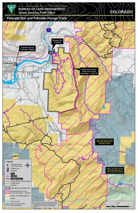
The Palisade Rim SRMA encompasses the rim and bench lands east of the Town of Palisade. Public lands and trails in the area are popular close-to-home recreation destinations for the community of Palisade, neighboring communities and seasonal tourism. The area offers outstanding views of the Grand Valley, the Colorado River, the Little Book Cliffs and the Grand Mesa. It also contains significant cultural and wildlife resources. The map also includes the Palisade Plunge Trail.
Download Files
Publication Date
Region
Grand Junction FO
Organization
Collection: Public Room
Category: Map
Keywords
Mountain Biking
Hiking