
Gateway Extensive Recreation Management Area – Tenderfoot Mesa Map
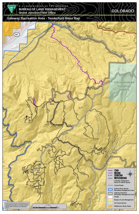
The Gateway ERMA – the Tenderfoot Mesa map provides visitors with opportunities to participate in motorized exploration, scenic touring and heritage tourism along the mesas and side canyons east of the town of Gateway. The ERMA provides a recreation setting with a relatively unchanged, natural-appearing landscape. Visitors to this portion of the ERMA have the opportunity to explore and connect to other public lands managed by the Grand Junction Field Office and the Uncompahgre National Forest.
Download Files
Publication Date
Region
Grand Junction FO
Organization
Collection: Public Room
Category: Map
Keywords
Hiking
Geology
Scenic Driving