
Ironwood Forest National Monument Map
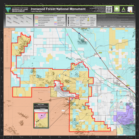
This is a map of Ironwood Forest National Monument, which is located in Arizona.
Key features of this map include transportation routes, as well as mountain ranges and recreation/interpretive sites within Ironwood Forest National Monument.
Transportation Route Designations:
- County Road: Existing road maintained by Pima or Pinal County. Accessible by passenger vehicle.
- Local Road: Some routes across private property may not have legal public access, and users should stay on the road. Routes are displayed for information purposes and do not grant access across non-BLM lands.
- Primitive Road: Minimally maintained routes, 4WD high-clearance vehicles recommended.
- Administrative Route: Administrative vehicles only. Route open to mechanized non-motorized public travel (bicycle, pedestrian, horseback riding).
- Trail: Maintained for non-mechanized and non-motorized access. Pedestrian and horseback riding accessible.
Travel routes depicted on this map across Arizona State Trust Lands or private lands do not imply legal public access to use or cross those lands. Any public use of State Trust Lands is strictly under the jurisdiction of the Arizona State Lands Department and use of private lands requires permission of the landowner. All users must comply with State policies and regulations and private landowner rights in order to legally use or traverse non-BLM lands.
While every effort has been made to ensure the quality of the information presented, the Bureau of Land Management (BLM) makes no warranty regarding the accuracy or completeness of this map. This map and data are representational and are to be used as intended by the BLM. Map data are compiled from various sources. This map and the data from which it was derived are not binding on the BLM and may be revised at any time. Produced July 2023.