
Colorado City Access Map
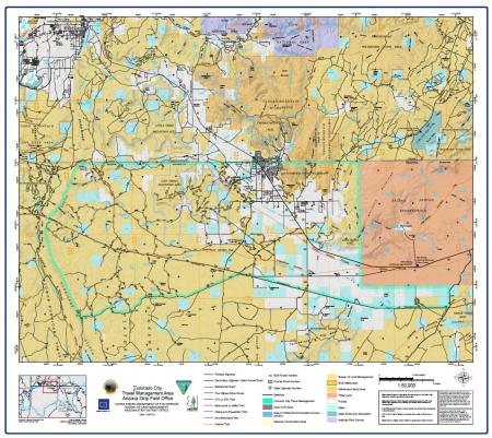
Colorado City Access Map, Arizona Strip Field Office
Main Gravel Road is considered the best access in the area. High-clearance vehicles are still recommended.
Maintained Road is fairly regularly maintained gravel or dirt route where high clearance and possibly four-wheel drive vehicles are recommended.
Four Wheel Drive Route is where classic four-wheel drive suspension is recommended.
UTV or ATV Trail is limited to vehicles with a width of 50 inches or less.
Motorcycle or eBike Trail is limited to single track modes of travel.
Travel routes depicted on this map across Arizona State Trust Lands or private lands do not imply legal public access to use or cross those lands. Any public use of State trust lands is strictly under the jurisdiction of the Arizona State Land Department and use of private lands requires permission of the landowner. All users must comply with State policies and regulations and private landowner rights in order to legally use or traverse non-BLM lands.
No warranty is made by the Bureau of Land Management as to the accuracy, reliability, or completeness of these data for individual use or aggregate use with other data. Original data were compiled from various sources. This information may not meet National Map Accuracy Standards. This product was developed through digital means and may be updated without notification