
Prescribed burns planned for southwest Colorado
DOLORES, Colo. – A series of prescribed burns are anticipated on approximately 2,285 acres managed by the Bureau of Land Management in southwestern Colorado. The U.S. Wildland Fire Service plans to treat areas in Dolores, San Miguel, and La Plata counties from now through May 2026.
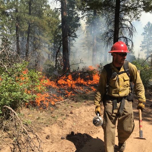
Prescribed burns help reduce hazardous fuels, improve wildlife habitat, and restore ecological health across public lands. Prescribed fire also helps protect nearby communities from the impacts of future large wildfires, including potential smoke‑related health and safety concerns. All prescribed fire activities will be implemented in accordance with approved burn plans and will occur only as safe and favorable weather conditions permit.
“We take advantage of the right weather windows to put good fire on the ground,” said Tyler Corbin, Fuels Specialist with the U.S. Wildland Fire Service. “Good fire now prevents bad fire later, helping to reduce risk for the community.”
Operations are planned at the following BLM locations:
San Miguel County: Operations are planned in the Dawson area, located south of Disappointment Valley, approximately 17 miles northeast of Dove Creek, and at Summit Point, approximately six miles southwest of Slick Rock and 2.5 miles east of the Utah border.
Dolores County: Operations planned in the Dawson area will also take place in Dolores County, located south of Disappointment Valley, approximately 17 miles northeast of Dove Creek. Other operations are planned in the West Rim area, approximately seven miles northeast of Dove Creek and four miles east of Highway 141.
La Plata County: Operations are planned in the Rabbit Mountain area, located south of CR 502 and approximately five miles northeast of Bayfield.
Smoke may be visible during active burning, especially in the afternoon, and could linger in low-lying areas during cooler evenings. Nearby communities may notice residual smoke as piles smolder post-ignition. Fire personnel will be on-site throughout operations to ensure public safety.
Prescribed fire smoke may affect your health. For more information, please visit the Colorado Air Pollution Control Division’s website at https://www.colorado.gov/pacific/cdphe/wood-smoke-and-health.
For additional information, visit the page for each project on InciWeb.
Summit Point: https://inciweb.wildfire.gov/incident-information/cosjd-summit-point-prescribed-burn
Dawson: https://inciweb.wildfire.gov/incident-information/cosjd-dawson-broadcast-prescribed-burn
West Rim: https://inciweb.wildfire.gov/incident-information/cosjd-west-rim-prescribed-burn
Rabit Mountain: https://inciweb.wildfire.gov/incident-information/cosjd-rabbit-mountain-prescribed-burn
Updates can also be found on the BLM's Southwest District Fire social media sites at https://www.facebook.com/BLMMontroseFireUnit and https://x.com/SWD_Fire.
For general information, contact John Wroblewski, USWFS Fire Mitigation Education Specialist, at (970) 240-5335. For media enquiries, contact Levi Spellman, Department of the Interior Public Affairs Specialist, at (719) 269-8553.
The BLM manages about 245 million acres of public land located primarily in 12 western states, including Alaska, on behalf of the American people. The BLM also administers 700 million acres of sub-surface mineral estate throughout the nation. Our mission is to sustain the health, diversity, and productivity of America’s public lands for the use and enjoyment of present and future generations.