
White Pocket Trailhead | Arizona
White Pocket Trailhead is a Bureau of Land Management-managed access point in northern Arizona’s Vermilion Cliffs National Monument, located near the Arizona-Utah border.
There are no developed trails in the area, and visitors are encouraged to explore. Park here and take the path that heads west from the parking area for about 100 yards.
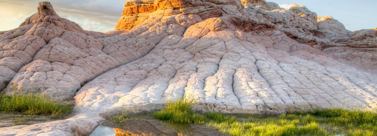
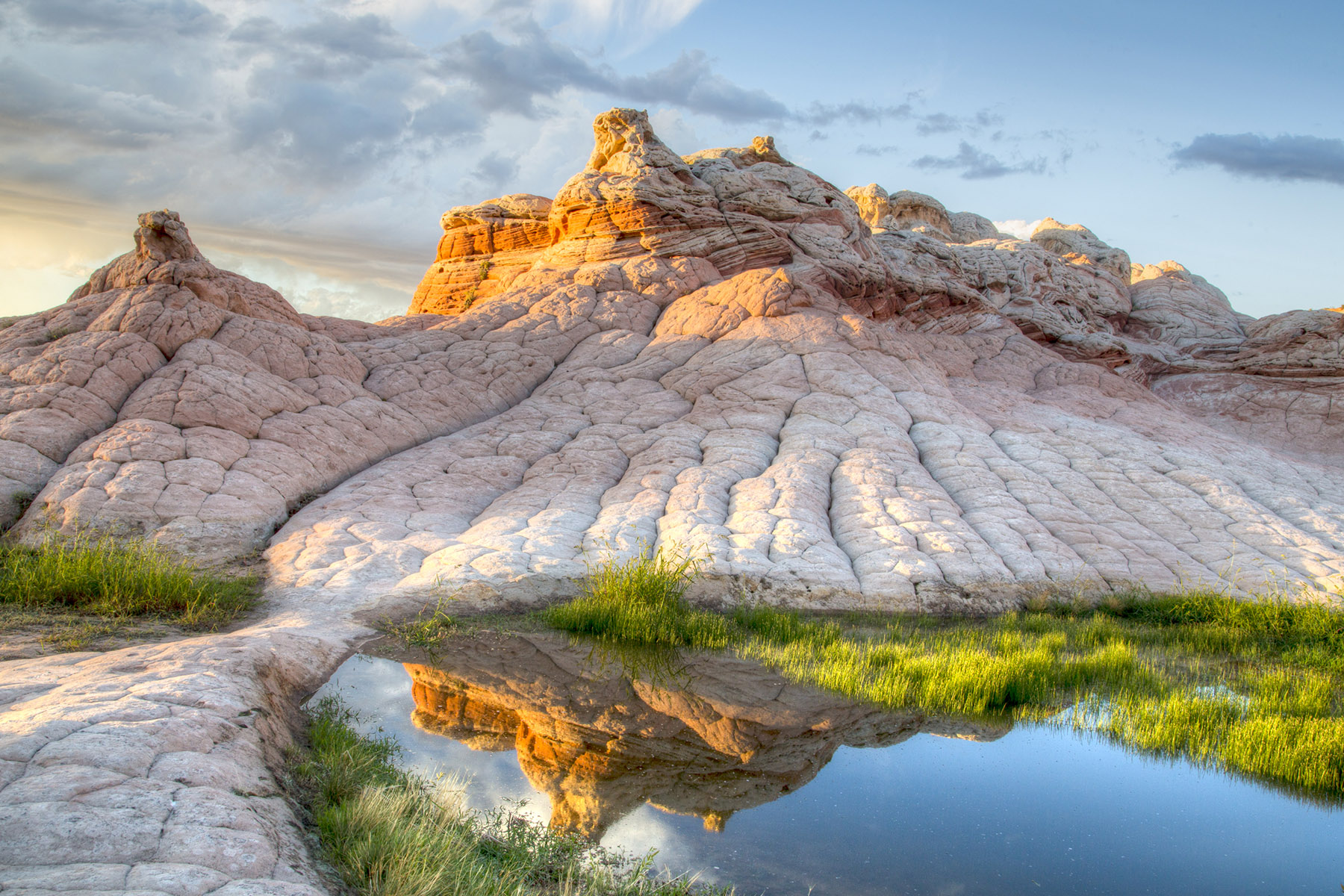
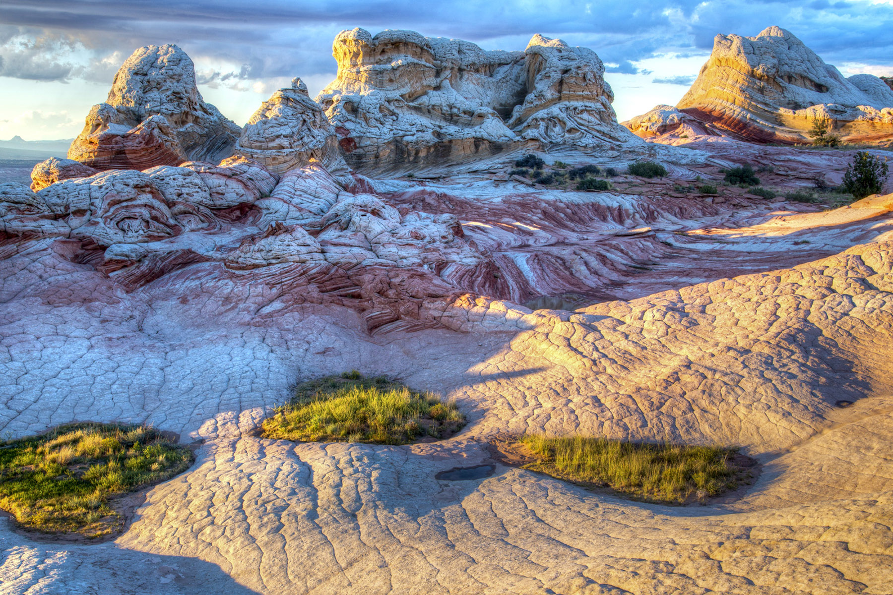
Enjoy exploring the awe-inspiring slickrock. These windswept layers of orange, yellow, and white formations were created over time by mineral deposits and shaped by the elements. Please help preserve the geologic formations so that present and future generations can enjoy them today and for years to come.
Safety and Conditions
You are responsible for your safety. If you get lost while hiking, experience a non-life-threatening emergency, or if your vehicle becomes stuck or breaks down, it is your responsibility, not the responsibility of emergency services or the Bureau of Land Management (BLM), to deal with the situation.
The roads that access White Pocket Trailhead consist of deep sand and patches of sharp rock. Four-wheel-drive high-clearance vehicles are required. Every year, many groups get stuck and stranded on the way to this trailhead as a result of attempting the drive without enough experience or in inappropriate vehicles.
If you are unsure of your vehicle’s capabilities or simply don’t want to assume the risk, BLM recommends hiring an authorized guide. Information about authorized guides may be found at BLM visitor centers or on our website.
Respect and Protect
The popularity of White Pocket is leading to impacts in the form of exposed human waste and toilet paper, excessive campfire rings, and vegetation damage. Please do your part to keep these areas clean and natural. Pack out all your trash, including food scraps and toilet paper.
If you camp in the area, use existing campsites, and keep them small. Bury human waste 6” deep, and well away from the campsite. To minimize your impact, do not damage trees or collect firewood.
Remember your OUTDOOR ETHICS when enjoying your public lands. Please RECREATE RESPONSIBLY.
Photos
Respect and Protect
The popularity of White Pocket is leading to impacts such as exposed human waste, toilet paper, excessive campfire rings, and vegetation damage. Please do your part to keep these areas clean and natural. Pack out all your trash, including food scraps, and toilet paper.
If you camp in the area, use existing campsites, and keep them small. In sensitive areas pack out human and pet waste. In less sensitive areas, bury human waste 6” deep, and well away from the campsite and pack out pet waste. To minimize your impact, do not damage trees or collect firewood.
Remember OUTDOOR ETHICS when enjoying your public lands. Please RECREATE RESPONSIBLY.
Contact Us

Activities


Addresses
Geographic Coordinates
Directions
White Pocket trailhead is accessed from the House Rock Valley Road (BLM 1065). To get to House Rock Valley Road from Kanab, UT, take Highway 89 east for 38 miles. From Page, AZ, take Highway 89 west for 36 miles. The south end of House Rock Valley Road intersects Highway 89A 13.5 miles east of Jacob Lake, AZ.
From House Rock Valley Road (BLM 1065) 23.5 miles south of Hwy 89 or 9.3 miles north of Highway 89A, turn onto BLM 1017. Drive east on BLM 1017 for 6.2 miles, and then proceed northeast on BLM 1087. Continue on BLM 1087 until it splits into BLM 1086. Stay left to follow BLM 1086 to the White Pocket Trailhead. Leave all gates as you find them.
Fees
None