
South Yuba Recreation Area | California
Remember your OUTDOOR ETHICS when enjoying your public lands. Please RECREATE RESPONSIBLY.
Overview
The South Yuba Recreation Area and National Trail is located approximately 10 miles northeast of Nevada City, California. The Recreation Area is administered by the Bureau of Land Management (BLM); U.S. Forest Service (USFS); and California Department of Parks and Recreation (State Parks/DPR). This 15 mile trail is open to hiking, horseback riding, trail running and mountain biking. The trail is closed to motorized vehicles. The South Yuba Recreation Area and Trail is open year-round.
The South Yuba Campground will close for the season on October 15th, 2026.
Facilities at South Yuba Campground:
- Includes sixteen (16) campsites for tents.
- Six (6) sites will accommodate small trailers/RV's.
- Fifteen (15) sites are ADA Accessible.
- RV maximum length is 22 feet. Trailer maximum length is 16 feet.
- All sites with tables, fire rings, pit toilets and trashcans.
- Bear proof lockers for food storage ONLY at each campsite.
- The South Yuba River is approximately one mile from the campground.
Campground Fees and Limitations:
- Campsites are first come first serve!
- There is no reservation system available.
- Must pay within 30 minutes of occupying site. Self-pay stations are available. More information below.
- Campsite Fee: $15.00 per night, per site
- Interagency Senior or Access Pass Campsite Fee: $7.50 per night, per site
- Accepted Forms of Payment: U.S. Currency or Check
- Check-out: 12 PM
- Eight people maximum per site. Two cars maximum per site.
- Fourteen (14) day camp limit within a 90 day period.
- Season of Use - April thru October 15th (depending on weather & maintenance)
Additional Camping Information:
- Self-pay Iron Ranger fee system. Please use the BLM provided envelopes with the pay-stub properly completed and attached to your campsite post. A campsite is rented ONLY once it has been paid in full w/pay-stub posted and the site is occupied by campers.
- Dispersed Camping is allowed along the South Yuba Trail outside of "high use" areas. You may park in the Day-Use parking area near the South Yuba Campground for a 72 hour period. Campfires are NOT allowed in dispersed camping areas year-round. Cook stoves are allowed with a valid California Campfire Permit. Bear proof lockers or trashcans are NOT available in dispersed camping areas. Please BE BEAR AWARE.
- Dogs are allowed at the South Yuba Recreation Area. Please keep your dog on a leash when in the South Yuba Campground. And for you and the dog's safety, we advise using a leash while hiking the South Yuba Trail. Please pick up after your dog. Thank you.
Return To: BLM, Mother Lode Field Office
Photos


THE SOUTH YUBA NATIONAL TRAIL
- You will cross private land along some trails. Please respect the rights of private landowners.
- River conditions vary, during spring runoff (April thru June). Some swimming areas maybe unsafe and not suitable for swimming. Please use caution.
- Gold panning is allowed in the South Yuba Wild & Scenic River “HANDS AND PANS” only. No sluice boxes or tools allowed.
- Edwards Crossing - NO over night camping. Over night parking OK. The area between a ¼ mile downstream and a ½ mile upstream from Edwards Crossing is a high-use recreation area - DAY USE ONLY.
- Purdon Crossing - NO over night camping. Over night parking OK. Approximately 1 mile from Purdon Crossing to China Dam is a high-use recreation area - DAY USE ONLY.
- Pack it In – Pack it Out and pack a little extra if you can. Help us keep your Public Lands clean and safe.
SITE DESCRIPTIONS
South Yuba Campground (BLM)
This site includes 16 campsites with tables, water, fire rings, pit toilets and trash pick-up. Pay sites, $15.00 per night, per site. The South Yuba Wild & Scenic River is approximately one mile from the campground. Season of use: Spring through Fall (weather permitting). Seasonal Closure: October 15th.
South Yuba National Trail (BLM)
This 15 mile trail is open to hiking, horseback riding, trail running and mountain biking. Trail is closed to motorized vehicles.
Purdon Crossing (BLM)
This crossing was known as Middle Crossing before William Robinson replaced the ferry with a toll bridge in 1854. A half-through metal truss bridge built in 1895 is used today.
Round Mountain Trail (BLM)
This is a steep 1½ mile trail leading from the Round Mountain Trailhead to the South Yuba Trail. The South Yuba Trail is 4.5 miles in length from Purdon to Edwards Crossing.
Edwards Crossing (BLM)
An original foot bridge in 1855. Nevada County purchased the bridge in 1889. This three-hinged metal arch bridge built in 1903 is still used today.
Illinois Crossing (BLM)
Located 1 mile from the South Yuba Campground, this site is open for primitive camping with tables. Illinois Bar (now Illinois Crossing) had a toll bridge in 1855.
Overlook Point Picnic Site (BLM)
This site is located 1½ miles east of the South Yuba Campground. Picnic tables are available on site.
North Canyon Trail (BLM)
Located 2½ miles east of the South Yuba Campground, this spur trail is ½ mile long with many switchbacks and ends at Long Point on the South Yuba Wild & Scenic River.
Humbug Creek Picnic Site (BLM)
Humbug Creek flows into the South Yuba Wild & Scenic River. The picnic site is located 4½ miles east of the South Yuba Campground and has picnic tables on site.
South Yuba Primitive Camp (BLM)
Located 0.3 mile hike east of the Humbug Creek Picnic site, this area is open to primitive camping with tables.
Spring Creek Trail (State Parks)
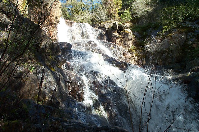
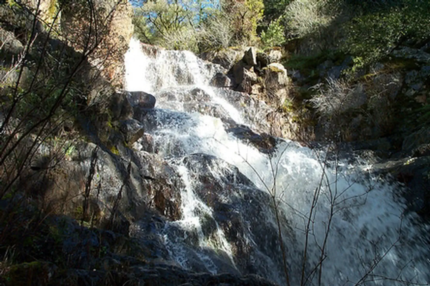
This trail is located on the north side of the bridge at Edwards Crossing. A ½ mile hike will take you to Spring Creek waterfall that flows into the South Yuba W&S River.
Humbug Trail (State Parks)
This 3 mile hiking trail parallels historic Humbug creek and provides access to Malakoff Diggins State Historic Park from the South Yuba Wild & Scenic River.
Rim Trail (State Parks)
This 3 mile hiking trail traverses the rim of the historic Malakoff Diggins.
Diggins Trail (State Parks)
This 3 mile hiking trail traverses the interior of the historic Malakoff Diggins.
Contact Us

Activities


Addresses
Directions
From Nevada City: Follow Highway 49 to North Bloomfield Road and travel ten (10) miles to South Yuba Recreation Lands. From the one lane bridge at Edwards Crossing it is approximately 1 1/2 miles on a dirt/gravel road to the campground.
PLEASE NOTE: the bridge at Edward Crossing has a 4 ton limit. RV's, trailers and vehicles over 4 tons not recommended.
For RV's/Trailers/Vehicles over 4 tons: Recommended Route - Follow Highway 49 to Tyler Foote Crossing. Turn right onto Grizzly Hill Road to the intersection with North Bloomfield Road and make a left turn. Proceed through a small residential area and make a right hand turn into the campground.
Fees
$15.00 / site / night
Additional Information
Helpful Links:
Be Bear Aware
Keep Me Wild: Mountain Lion (CDFW webpage)
Dreamflows Home Page (River flow info courtesy of Chris Shackleton, Sacramento, CA)
Return To: BLM, Mother Lode Field Office
Recreation Passes: America the Beautiful — National Parks and Federal Recreational Lands Pass
SOUTH YUBA CAMPGROUND
16 campsites for tents or RV's
Piped water
Pit toilets (wheelchair bound person will require assistance)
Picnic tables
Fire grills
Garbage collection
Fee: $15.00 per night, fourteen (14) day camp limit within a 90 day period.
Reservations: none required, first come first serve basis.