
Lava Flow Trail | Arizona
In the Table Top Wilderness within the Sonoran Desert National Monument, the Lava Flow Trail offers a hiking opportunity of light to moderate difficulty in a varied and dramatic Sonoran Desert landscape.
Three trailheads are linked by a relatively level 7.25-mile trail.
From south to north, the trail meanders through dense forests of saguaro, paloverde, ironwood, and cholla; skirts the jumbled basaltic slopes of Black Mountain; traverses an extensive creosote-bush flat; and crosses several large washes.
Lava Flow Trail provides sweeping views of Vekol Valley and the Sand Tank Mountains to the west, while flat-topped Table Top Mountain — highest point in the Table Top Wilderness — looms to the east.
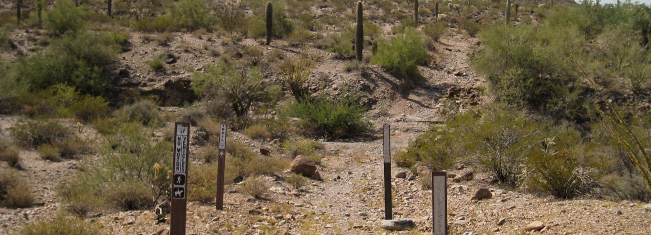
Only hiking and equestrian use is allowed on the trail in wilderness under the Wilderness Act of 1964. Motorized vehicles and mountain bikes are prohibited in wilderness. Motorized and mechanized vehicles, including bicycles, must remain on existing access routes.
Motorized equipment and equipment used for mechanical transport are generally prohibited on all federal lands designated as wilderness. This includes the use of motor vehicles (including OHVs), motorboats, bicycles, hang gliders, wagons, carts, portage wheels, and the landing of aircraft including helicopters. Contact the agency for more information about regulations.
Road conditions to the wilderness vary with high-clearance and four-wheel-drive vehicle requirements. Roads are primitive and not maintained. Have a full tank of gas, full-size spare tires, a vehicle tool kit, and first aid kit. The main access routes and washes are prone to heavy seasonal rains and flash floods. Do not cross flooding streams or washes!
Hours and Seasons
Trail can be used year-round; however, it is recommended for use from November through April. At other times of the year, the trail is seldom used due to high temperatures.
Summer temperatures may often reach 115 degrees. Wear a hat, long sleeve shirt, sunglasses, and sunscreen. Drink plenty of water!
Features and Services
- Drinking Water: There is no drinking water available. Bring plenty of water.
- Toilets: Accessible vault toilet onsite.
- Cell Phone and Internet: Cell phone service may be unreliable across the Sonoran Desert National Monument. There is no public internet or Wi-Fi.
- Pets: Service dogs are legally permitted anywhere that visitors can go. Pack out all waste.
Safety and Conditions
You are responsible for your own safety. Call 911 to contact local law enforcement, obtain emergency services, or report a fire. Keep in mind that there is no first aid available on-site.
Expect potential hazards such as venomous snakes, extreme heat, and flash floods. Be prepared for changes in weather and stay informed on weather warning alerts. Make sure you have the appropriate gear, food and water.
You might encounter rattlesnakes and scorpions. Don't put your hands or feet in brush or under rocks and boulders.
Many abandoned mine shafts dot the landscape in Arizona and are very dangerous. Many shafts are deep vertical holes with no way out. Do not get close to or enter any mine shaft.
Drug and human smuggling activities have occurred within the monument south of Interstate 8. If you see any activity that looks illegal, suspicious, or out of place, please do not intervene. Contact BLM Federal Law Enforcement Communications Center, County Sheriff or Border Patrol. Call 911 to report emergencies.
Respect and Protect
The area is home to many species of wildlife. Please remember to practice outdoor ethics and recreate responsibly. Help us protect this unique environment by leaving no trace during your visit.
Check for fire restrictions before your visit. Using exploding targets, fireworks, sky lanterns, tracer ammunition and other incendiary devices is prohibited on BLM-managed public land in Arizona.
Report crimes to resources including vandalism, dumping and suspicious activity at 1-800-637-9152.
Accessibility Description (ABA/ADA)
The parking area consists of hard-packed ground with non-striped spaces. Although none of the spaces are designated as accessible, the entire parking area should be suitable for people with mobility devices.
Descriptions and photos uploaded December 2025. Please note that actual on-the-ground conditions may vary due to natural events (e.g., weather, wildfires, erosion), normal wear and tear, or site improvements.
Contact Us

Activities


Addresses
Directions
Lava Flow Trail is accessed at three points. Exit Interstate 8 at the Vekol Valley Interchange (Exit 144) approximately 26 miles east of Gila Bend and 34 miles west of Casa Grande.
A high-clearance vehicle is required to access Lava Flow South Trailhead. Four-wheel drive is required to access Lava Flow North and West trailheads.
To access Lava Flow West and South trailheads, travel south on Vekol Valley Road (BLM Route 8007) 2.1 miles to the Vekol Ranch turnoff. An information kiosk will be on your right. For the West trailhead, continue south on Route 8007 for 5.7 miles. Turn left on BLM Route 8046 and travel 2 miles to the trailhead. For the South trailhead, continue for 8.7 miles south from the kiosk to BLM Route 8024. Turn left onto Route 8024 and travel 3.7 miles to the trailhead.
To access Lava Flow North Trailhead, travel south on Vekol Valley Road 0.7 miles from Interstate 8 and turn east onto BLM Route 8043. Continue east 2.8 miles to Route 8042. Turn right and drive 2.3 miles, keep left to stay on Route 8042, and continue 3.3 miles to the trailhead.
External Map
Fees
There are no permits, passes, or fees required to visit this wilderness area. It is free.
However, commercial, competitive, and large organized group events require a special recreation permit. Contact the local managing field office for more information about special recreation permits.
Recreational activities on any nearby state trust land require a permit from the State of Arizona.
Visits to the Sand Tank Mountains, located south of Interstate 8, require a free Barry M. Goldwater Range permit. Permits are only available online and not at the local BLM office.
Stay Limit
Dispersed camping is generally allowed on public land for a period not to exceed 14 days within a 28 consecutive day period.