

Railroad Flat Campground | California
Reservations are REQUIRED for all campgrounds.
Download the app to your phone before arriving: Recreation.gov
Overview
Merced River Recreation Management Area Overview
The Merced River Recreation Area is a special place just downstream from Yosemite. It is well known for excellent whitewater boating, wildflower viewing, camping, swimming, and recreational gold panning/prospecting.
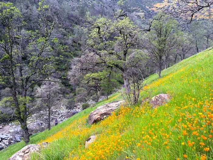
Visitors will have plenty to do in the Merced River Recreation Area during every season. Springtime comes early to the Merced River Canyon and by March the wildflower season is well on its way—lasting into May. Easy access, un-damned flows, and excellent whitewater boating attract rafters and kayakers during the spring runoff (April through July). Commercial rafting trips are available from the following BLM permitted outfitters: All Outdoors, ARTA, OARS, and Zephyr (Contact outfitters directly for more information). It is a very popular swimming destination during the hot California foothill summers with some of the clearest swimming hole around. Gold panning and prospecting have never fallen out of favor since the 1850’s when this canyon had a large mining population. In autumn the crowds subside and the Merced River Recreation Area provides more solitude while still offering most of the appeal and activities as earlier in the year. By winter, true solitude can be found. The weather is usually quite warm and sunny between storms. Daytime highs in the 60’s and overnight lows in the 30’s are common.
While some activities are best in specific seasons, there are many things to do all year long. Bird watching is good throughout the area most of the year. Fishing is popular for trout and bass along the entire river. Biking along the gravel roads and trails is popular with families and experienced mountain bikers alike. Hiking is great anytime of the year. The Merced River Trail continues on downstream from the end of the campground River Road and brings hikers or bikers to the North Fork of the Merced and beyond. The Burma Grade is another popular route to explore on foot, bike, or high-clearance automobile. This scenic backroad climbs steeply out of the Merced Canyon and eventually leads to Greely Hill or Buck Meadows (CA-120).
Railroad Flat Campground Overview
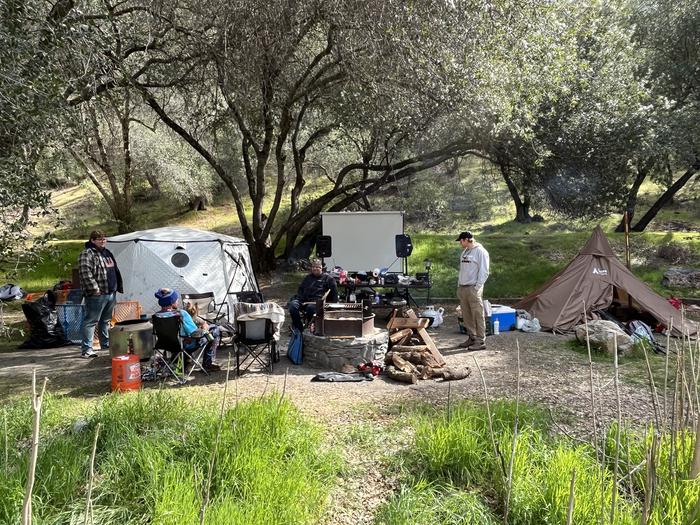
After crossing the historic Briceburg Suspension Bridge, Railroad Flat Campground is 4.5 miles downstream along the Merced River Road. This is the last of three campgrounds operated by the Bureau of Land Management (BLM) along the Merced Wild & Scenic River. This is a popular destination campground during spring and summer.
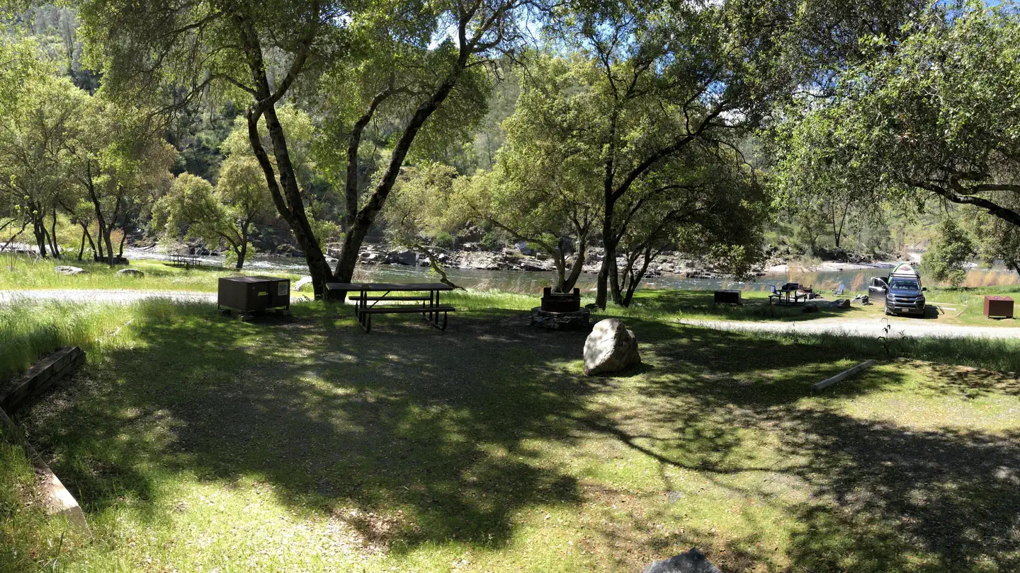
There are three (3) walk-in campsites and six (6) drive-up campsites. The walk-in sites are between 50 and 200 feet from the parking lot. An accessible crushed rock trail leads to each site.
Recreation
The Merced River Recreation Management Area was established due to the outstanding recreational opportunities found here. The proximity to Yosemite National Park attracts people from around the world to camp, boat, swim, and play along the Merced River.
Whitewater rafting opportunities are excellent with easy road-side access. Established launch sites upstream near El Portal are Redbud, Indian Flat, Old Suspension Bridge, and Briceburg Day-Use Area. Take-out locations include Briceburg Day Use Area, Railroad Flat Boat Ramp, and Bagby.
Hiking along the Merced River Trail/Old Yosemite Railroad Grade is good year around.
Camping along the Merced River has been a cherished recreational activity for generations of families for a hundred years. Picnicking, nature study, hobby gold prospecting, wildflower viewing, birding, mountain biking, and swimming are all popular recreational activities within the Merced River Recreation Management Area/Merced Wild & Scenic River.
Facilities
Each of the three BLM Merced River Campgrounds includes the following features:
• Vault toilet(s), and seasonal port-o-potties
• Bearproof garbage cans.
• Bearproof recycling cans.
• Bearproof food locker in each site
• Picnic table in each site
• Fire ring in each site
• Bulletin board with local information, rules and regulations
• Parking areas.
• Self-pay fee system.
• McCabe Flat Campground has a designated swimming area—NO DOGS ALLOWED.
Natural Features
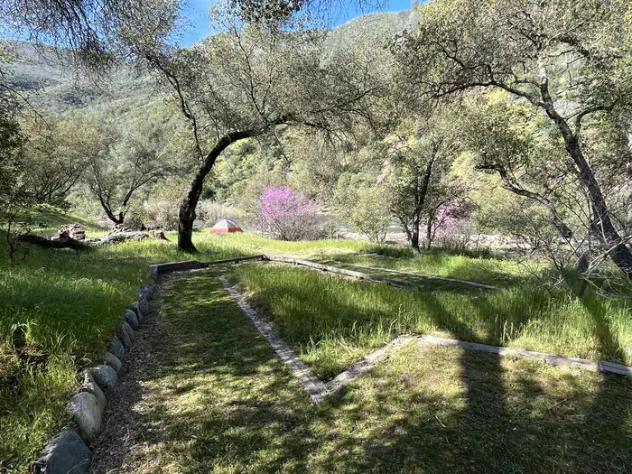
Railroad Flat Campground is situated on the shore of the Merced Wild & Scenic River. All of the nine (9) campsites are within 100 feet of the river. The river is the main natural feature here; as well as easy access to the Merced River Trail just beyond the campground.
The Merced River Trail follows the Old Yosemite Railroad grade past where cars can drive. This trail is spectacular during springtime (February-April)! It provides good access to more secluded swimming and fishing holes downstream from the campgrounds. This trail also provides access to the North Fork of the Merced River where swimming and wildflower viewing is excellent in spring to early summer.
Wildflower viewing is great all along the Merced River. The best season to see the colorful display is February through April.
California Newts are common in this area. They are active in the winter and spring especially on wet days. They are slow moving docile creatures, but do not touch or pick them up. They have a neurotoxin in their skin that is poisonous to people and pets. Do not eat them.
Nearby Attractions
Yosemite National Park is the main attraction in Mariposa County. The Arch Rock Entrance Station is 25.1 miles from McCabe Flat Campground (20 miles from Briceburg Visitor Center on CA-140).
California State Mining and Mineral Museum is located at the Mariposa County Fairgrounds--14.2 miles from the Briceburg Visitor Center.
Mariposa Museum and History Center is in downtown Mariposa 12 miles from Briceburg Visitor Center. 5119 Jessie St Mariposa, CA 95338
Charges & Cancellations
Reservation Rules
Maximum Consecutive Stay You may stay up to 14 nights during a visit at this campground.
Maximum Stay You may stay up to 14 nights total at this campground within any calendar quarter (Jan-March, April-June, etc)
Max Concurrent Stay You may hold up to 2 reservations on any given night at this campground. Each campsite is its own reservation. All Year
Maximum Reservations per Transaction You may pay for up to 2 reservations at one time within the same credit card transaction. All Year
Maximum Total Reservations You may hold up to 2 current or upcoming reservations at this campground. All Year
Maximum Reservation Changes You may modify this reservation up to 2 times. Modifications only count towards this rule if there is a change in balance. It does not impact other reservation data in the order details. Reservation creation does not count towards this rule. All Year
If I book this reservation today, what are my options to change or cancel?
Please remember that reservations at these facilities prevent other visitors from using these sites. Planned changes to your stay should be made as far in advance as possible. You can make changes to your reservation ahead of your arrival date in My Reservations.
Changes
If your new stay dates are completely different from your original stay dates, there is a $10 change fee (per reserved site). There are no additional fees for:
• Adding or removing nights to your stay.
• Changing to a different campsite.
Balances will adjust based on your new stay's nightly rate.
Cancellations
You can cancel the reservation any time before the date of your scheduled arrival. You will receive a refund for your stay, minus the following fees:
• $10 cancellation fee
• Any reservation fees (only if paid when booking)
• Any previous change fees
Late cancellation penalties may also apply:
What is “Late”?
For individual campsites, a late cancellation applies starting from midnight 1 calendar day before your scheduled check-in. For cabins and group sites, a late cancellation applies starting from midnight 14 calendar days or fewer before your scheduled check-in.
Late Fee
In addition to the fees listed above, a late cancellation will also subtract your first night's recreation use fee from any refund owed. As of the expected check-in day, cancellations or changes to your stay are not possible through My Reservations. It is at the facility's discretion to support additional Late Cancellations, No Show, or Early Departure updates – on-site personnel may not be able to assist. These changes carry penalties and may forfeit recreation use fees. For additional details, please visit here.
Changes and Cancellations
Cancellations more than 48 hours in advance of arrival date only incur a $10 transaction fee. Within 48 hours, $10 and the first night's fee are charged (Exception: 1 night reservations do not incur an additional $10 fee, but do not receive a refund). No-shows will be assessed a $20 service fee along with the loss of the first night's fee.
No-Shows
A no-show customer is one who does not arrive at the campground and does not cancel the reservation by check-out time on the day after the scheduled arrival date.
No-show customers are assessed a $20.00 no-show fee and forfeit the first night's fees for a campsite
the remainder of the reservation is cancelled if campsite is booked for more than one night.
Photos


Accessibility Description (ABA/ADA)
At least 90% of all campsites are ADA accessible
MERCED RIVER TRAILHEAD (RAILROAD FLAT)
Merced River Trail:
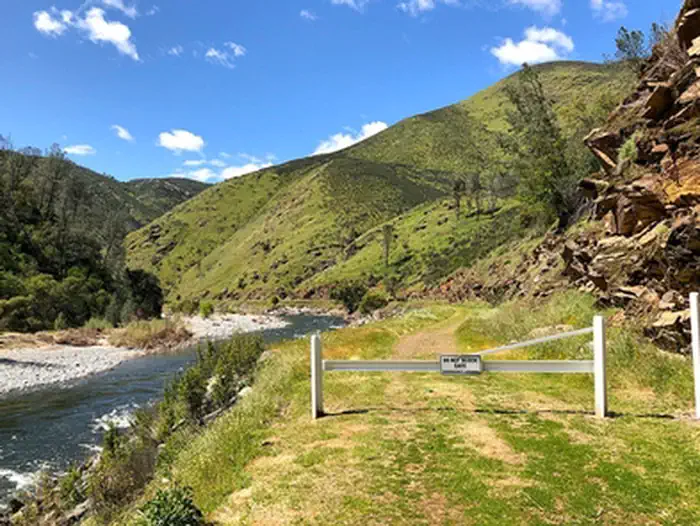
The Merced River Trail follows the old Yosemite Valley Railroad Grade for 28 miles from Bagby, on Highway 49, to El Portal, near the Arch Rock entrance to Yosemite National Park. The trail is not maintained for that entire distance. The BLM manages the lower 18 miles, while the USFS manages the remaining 10 miles closest to El Portal. This trail is primitive and is constantly subject to rock and mud slides. It is common for trees to fall across the trail at any time of year. All side-creek crossings are rough and will require a mountain biker to “carry” across the gulches.
The BLM does try to maintain two sections of this trail to a more use-friendly standard. But, even within these two sections, there are rough patches, portages, and re-routes that traverse rock slides etc. Every season presents new challenges and wash-outs so expect the unexpected. The maintained sections of the Merced River Trail are from Railroad Flat to the North Fork, and from Briceburg to the Forest boundary.
Merced River Trailhead (Railroad Flat):
From Briceburg, cross the suspension bridge and head downstream on the Briceburg River Road past all three campgrounds and park at the road’s end (4.5 miles). Do not block gate.
This trailhead serves hikers, and mountain bikers access to the North Fork Merced and continues downstream to Bagby. (Equestrian riders will have difficulty passing Halls Gulch which is only 1/8 mile from the trailhead). This is a very good wildflower viewing trail during spring (February through April). There is no bridge at the North Fork so expect to get wet if you are heading all the way to Bagby. The North Fork Merced can get too high to cross during rainy periods in winter and spring. By summer, the flow is usually modest enough to cross knee high to ankle deep. Trail condition deteriorates rapidly downstream from the North Fork along the main Merced River Trail.
The main attraction from this trailhead is the North Fork Merced which offers excellent wildflower viewing in spring and great swimming late spring and summer. The main Merced River has great swimming holes near the confluence with the North Fork. Backcountry camping is allowed here. Make sure you have a valid fire permit if camping overnight. Check fire restrictions before your trip—usually no fires by early summer.
The trail up the North Fork is narrower and steeper than the main Merced River Trail. Poison oak and rattlesnakes are common here. The North Fork Trail leads to a beautiful bedrock gorge with a small cascade about ¾ of a mile upstream from the confluence. The trail deteriorates rapidly after the falls, eventually disappearing in a distance.
Contact Us

Activities


Addresses
Geographic Coordinates
Directions
From Mariposa, take CA-140 east to the visitor center, where the highway first meets the Merced Wild & Scenic River. Turn into the visitor center and cross the Suspension Bridge. Follow the Briceburg Campground Road downstream 4.5 miles to Railroad Flat Campground.
From Yosemite/El Portal, take CA-140 west (downstream) to the visitor center, where the highway starts to climb away from the Merced Wild & Scenic River. Turn into the visitor center and cross the Suspension Bridge. Follow the Briceburg Campground Road downstream 4.5 miles to Railroad Flat Campground.
Fees
Booking Windows
Individual sites at this campground are block released on the 15th of each month:
Facility Rates
Facility rates by season dates
SEASON DATES SITE TYPE NIGHTLY/DAILY RATES *
January 01- December 31 Standard Nonelectric $20.00
Group Site (up to 20 people) $40.00
* Displayed rates include any/all associated fees and do not reflect discounted rates.