
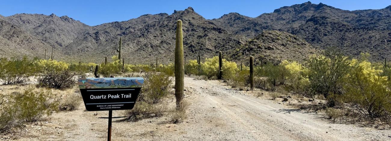
Quartz Peak Trail | Arizona
Quartz Peak Trail, in the 14,400-acre Sierra Estrella Wilderness, leads visitors from the floor of Rainbow Valley (elevation 1,550 feet) to the summit ridge of the Sierra Estrella at Quartz Peak (elevation 4,052 feet) in just three miles. Along the way, visitors are treated to a variety of Sonoran Desert plants and wildlife, scenic vistas, and evidence of the area's volcanic history.
Quartz Peak Trail is extremely steep and difficult to follow in places. This is a hike for experienced and well-conditioned hikers only! The trail begins at Quartz Peak Trailhead by following a closed four-wheel-drive track for approximately 0.25 mile. Look to the left as you walk up the old road and see a narrow trail ascending the ridge to the north. The trail is poorly marked in places and does not extend to the summit — the final 0.25 mile to Quartz Peak is a scramble over boulder and talus slopes that requires careful footing. Quartz Peak is a point on the spine of the Sierra Estrella capped with an outcrop of white quartz.
The views from the summit are spectacular. To the west, there is a dramatic panorama of rugged mountain ranges and desert plains. To the east, metropolitan Phoenix unfolds over the valley of the lower Salt River.
Hours and Seasons
Trail can be used year-round; however, it is recommended for use from November through April. At other times of the year, the trail is seldom used due to high temperatures.
Summer temperatures may often reach 115 degrees. Wear a hat, long sleeve shirt, sunglasses, and sunscreen. Drink plenty of water!
Features and Services
- Drinking Water: There is no drinking water available. Bring plenty of water.
- Toilets: Accessible vault toilet onsite.
- Cell Phone and Internet: Cell phone service may be unreliable. There is no public internet or Wi-Fi.
- Pets: Service dogs are legally permitted anywhere that visitors can go. Pack out all waste.
Safety and Conditions
You are responsible for your own safety. Call 911 to contact local law enforcement, obtain emergency services, or report a fire.
While enjoying your visit, keep in mind that there is no first aid available on-site.
Expect potential hazards such as venomous snakes, extreme heat, and flash floods. Be prepared for changes in weather and stay informed on weather warning alerts. Make sure you have the appropriate gear, food and water.
Respect and Protect
The area is home to many species of wildlife. Please remember to practice outdoor ethics and recreate responsibly. Help us protect this unique environment by leaving no trace during your visit.
Check for fire restrictions before your visit. Using exploding targets, fireworks, sky lanterns, tracer ammunition and other incendiary devices is prohibited on BLM-managed public land in Arizona.
Report crimes to resources including vandalism, dumping and suspicious activity at 1-800-637-9152.
Accessibility Description (ABA/ADA)
The parking area consists of hard-packed ground with non-striped spaces. Although none of the spaces are designated as accessible, the entire parking area should be suitable for people with mobility devices.
This trail may pose challenges to visitors with mobility impairments.
Contact Us

Activities


Addresses
Directions
The Quartz Peak Trail is in the Sierra Estrella Wilderness. It is accessed from Rainbow Valley and Riggs Roads, approximately 25 miles southwest of Phoenix.
Drive west on I-10 to exit 126 and go south on Estrella Parkway to Elliot Road. Turn right on Elliot and go west to Rainbow Valley Road. Turn left and follow Rainbow Valley Road south about 9.3 miles until the pavement ends at Riggs. Turn left on Riggs Road and drive east 4.0 miles to Bullard Ave.Turn right, cross the culvert and make an immediate left onto the dirt road (Riggs).
Continue east, following the “TRAIL” signs, 5.3 miles to the Powerline Rd. (Part of the road is very sandy, high clearance vehicle required.) Turn right and continue 1.9 miles. Turn left at the brown “TRAIL” sign. The trailhead is another 1.9 miles east of the power line.
Fees
There are no permits, passes, or fees required to visit this trail or wilderness area. It is free.
However, commercial, competitive, and large organized group events require a special recreation permit. Contact the local managing field office for more information about special recreation permits.
Recreational activities on any nearby state trust land require a permit from the State of Arizona.
Stay Limit
Dispersed camping is generally allowed on public land for a period not to exceed 14 days within a 28 consecutive day period.