
Mule Creek Trail | Oregon
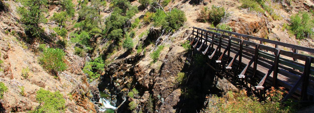
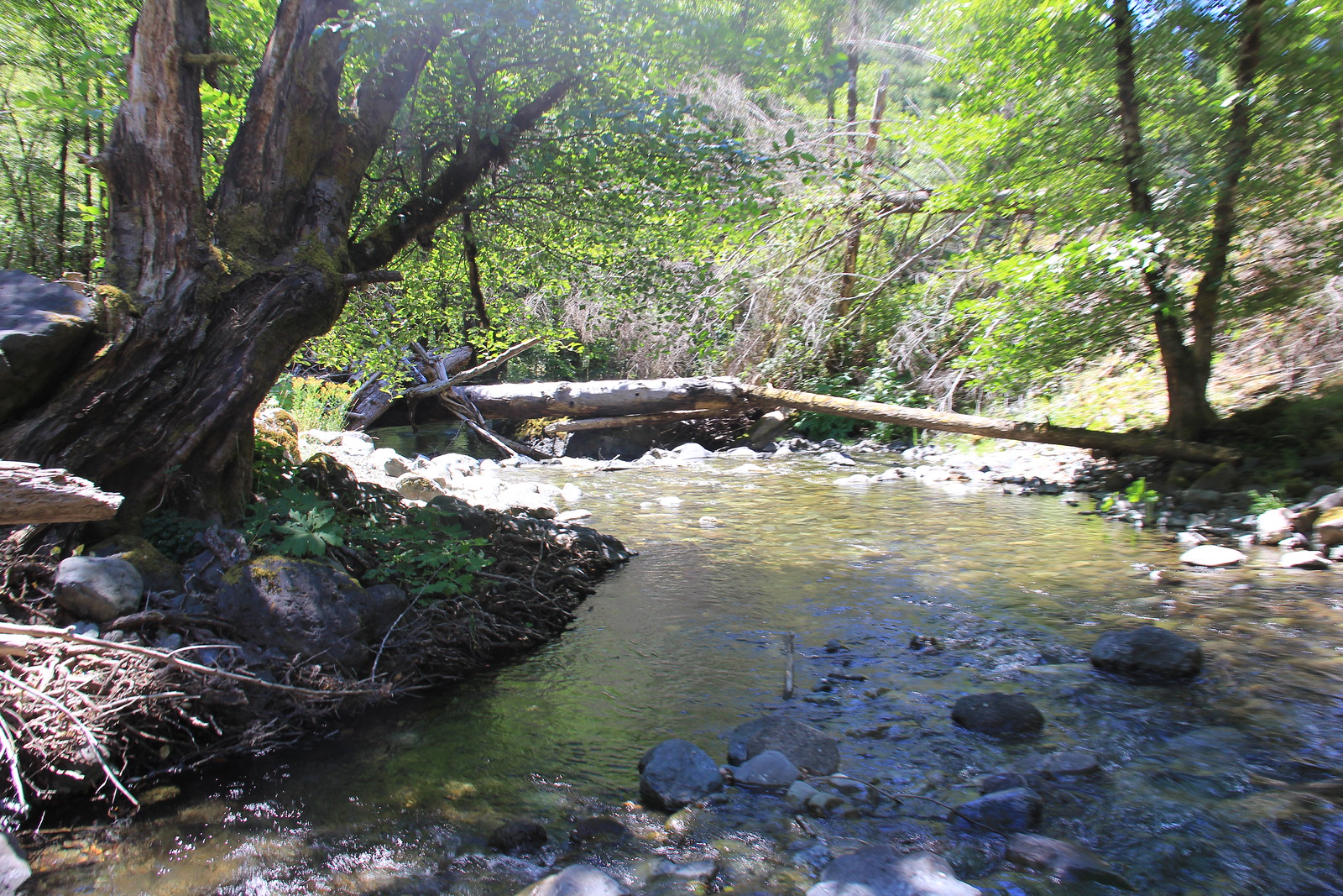
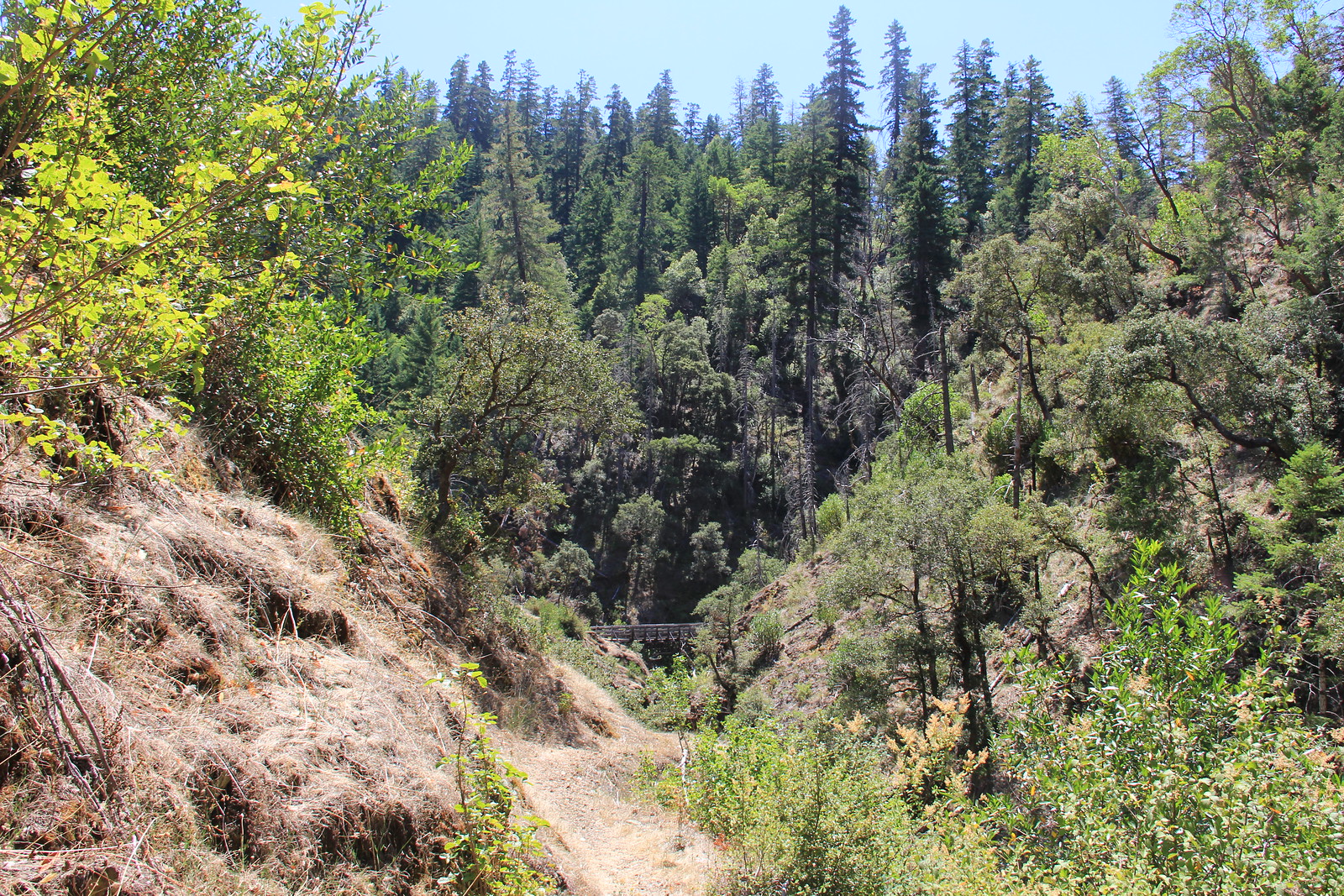
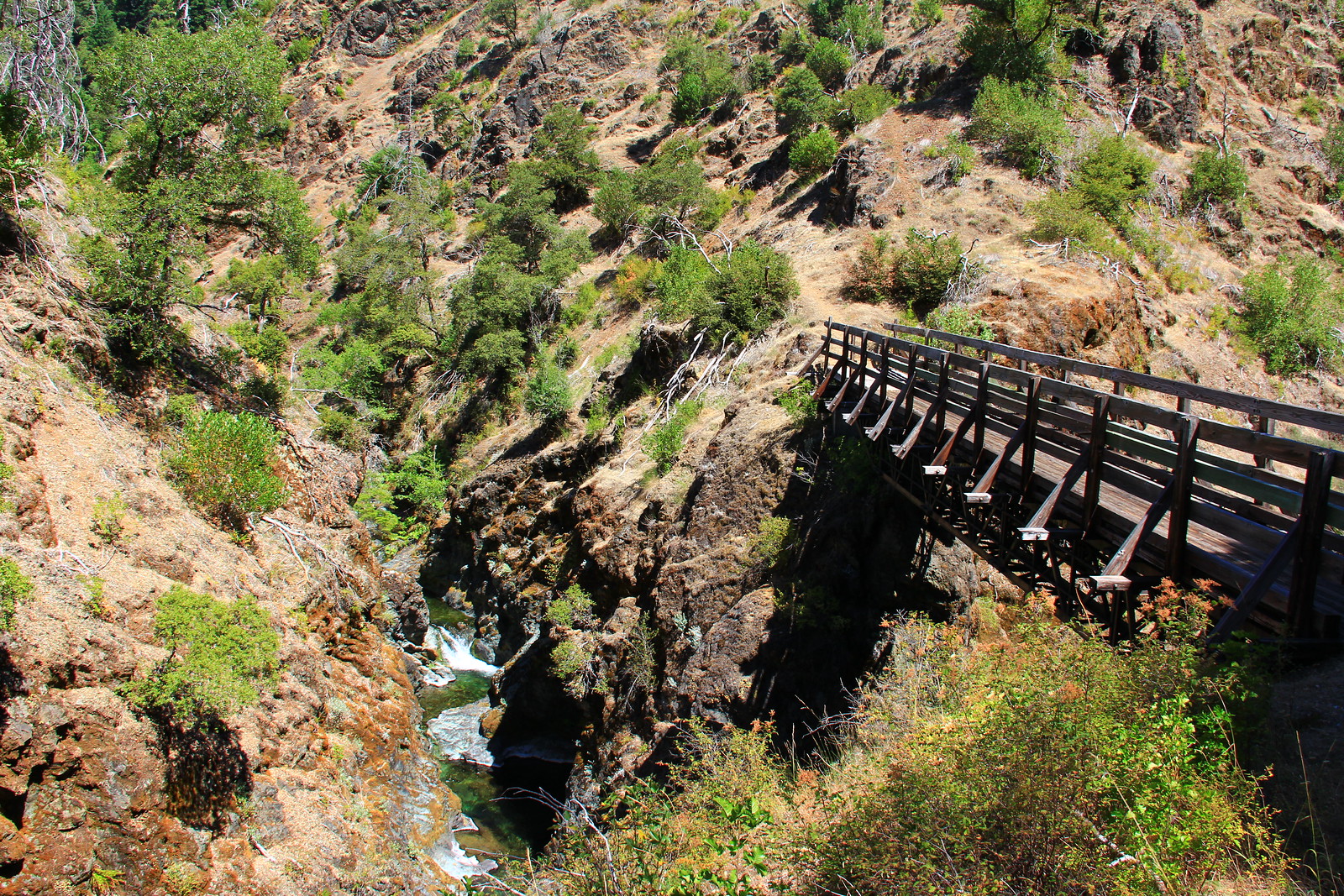
The Mule Creek trail is located in the Wild Rogue Wilderness and meanders along vertical bluffs high above Mule Creek and East Fork Fork Mule Creek Canyons. This trail was constructed in the early 1900s and historically has been used by miners and other early settlers as a pack trail to haul supplies into the backcountry. The U.S. Forest Service also used it to reach the lookout tower at Hanging Rock and the guard station at Marial. Hikers will enjoy a part of our history as well as scenic views, wildflowers and wildlife.
The best time to hike the trail is in the Spring or Fall. Summer temperatures can reach 100 degrees F on south-facing slopes. Camping along the trail is at dispersed sites. Carry water with you. Water is available near the south trailhead at the Rogue River Ranch. The water at Tucker Flat Campground is not potable; the north trailhead has no spring water.
The north end of the trail connects with the Panther Ridge trail, Forest Service trail #1253. The south end of the trail is 1/2 mile from the Rogue River Ranch.
Know Before You Go
- From Tucker Flat Campground, the trail climbs approximately 3000 vertical feet over 6.5 miles.
- Tucker Flat Campground is a no-host campground with six campsites with no hook-ups and no potable water. This year-round, first-come first serve campground features pit toilets, picnic tables and is situated along the Grave Creek to Marial Back Country Byway.
- The 35,221-acre Wild Rogue Wilderness is co-managed by the Bureau of Land Management and the U.S. Forest Service.
Point of Interest
The 40-mile long Rogue River National Recreation Trail can also be accessed near the Tucker Flat Campground.
Photos
Contact Us

Activities


Addresses
Directions
Access to the North end
From the West: From Gold Beach on SR 101, take County Road 595 East to Forest Service Road 33. Continue on FS road 33 to FS road 3310, following it until FS road 3340. On FS road 3340, travel NW until it connects with FS road 33. Take a right at the intersection with FS road 3348 and continue on to the Buck Creek campground where you will turn right on FS road 5520. FS road 5520 will take you to the parking area for the trail.
From the East: From the Glendale exit on I-5 go west and into town where you will head northwest on County road 27, continuing on as it becomes BLM road 33-7-2. At intersection of Cow Creek and West Cow Creek roads go left, following West Cow Creek (BLM road 32-8-1.1). Approximately three and one-half miles take a left onto the Bobby Creek Road (BLM road 32-8-9.2) following it up to Nine Mile Saddle. Go right and continue on Kelsey Mule Road (BLM rd 32-8-3.1) through Anaktuvuk Saddle and west until it becomes Forest Service road 5520. Follow FS road 5520 to the parking area.
Access to the South end
From I-5 take the Merlin Exit. Drive west on the Merlin-Galice Road approximately 23 miles. Continue across The Grave Creek Bridge and onto the Mt. Reuben Road (BLM rd 34-8-2) until it junctions with the Kelsey Mule Road, go left. Approximately 1/4 mile west, at Marial Saddle, go left on Marial Road (BLM rd 32-9-14.2) following signs to Tucker Flat Campground. Trailhead is at rear of campground.
External Map
Fees
No Fees.