
Cowiche Canyon Trail System | Washington
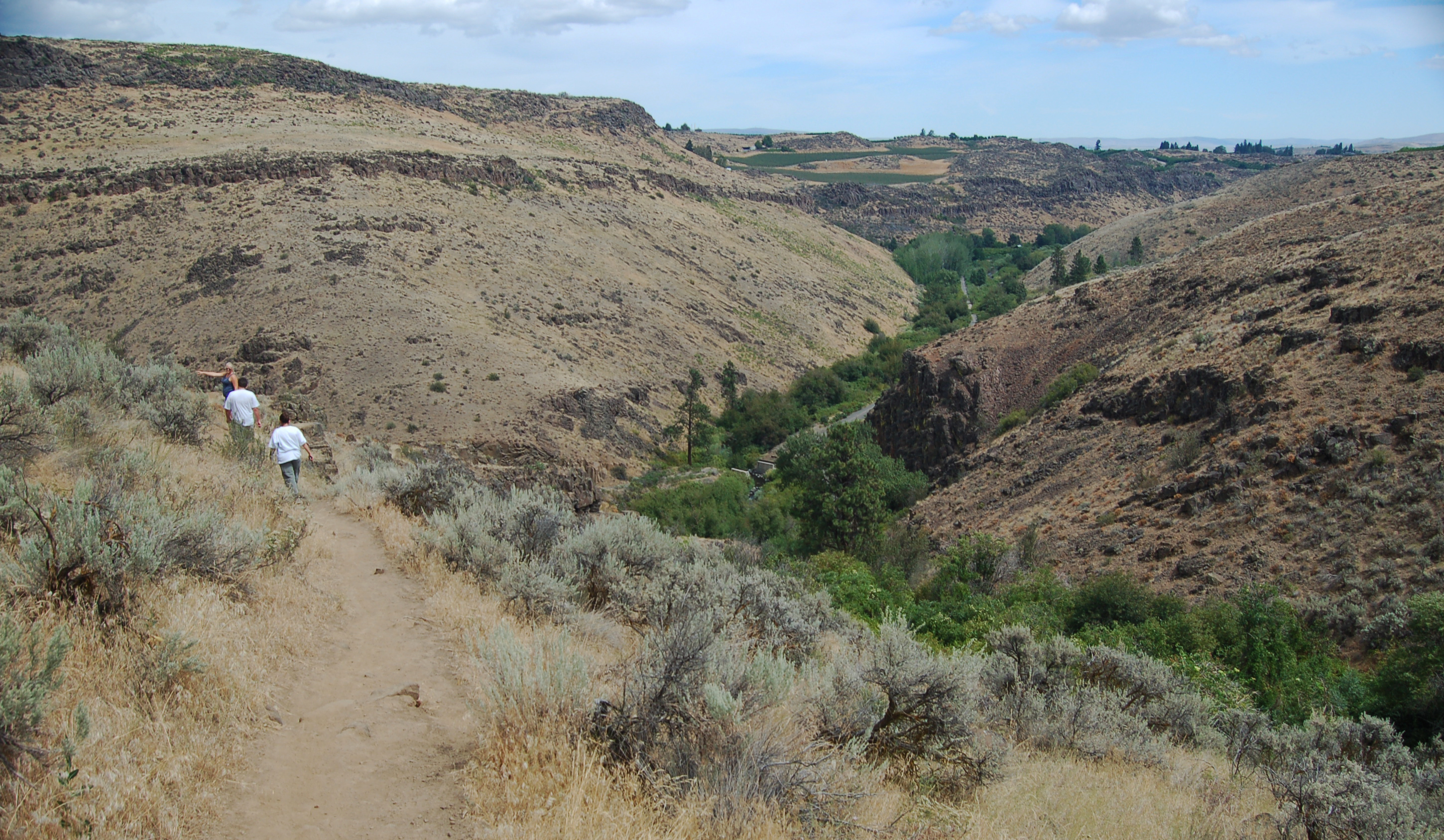
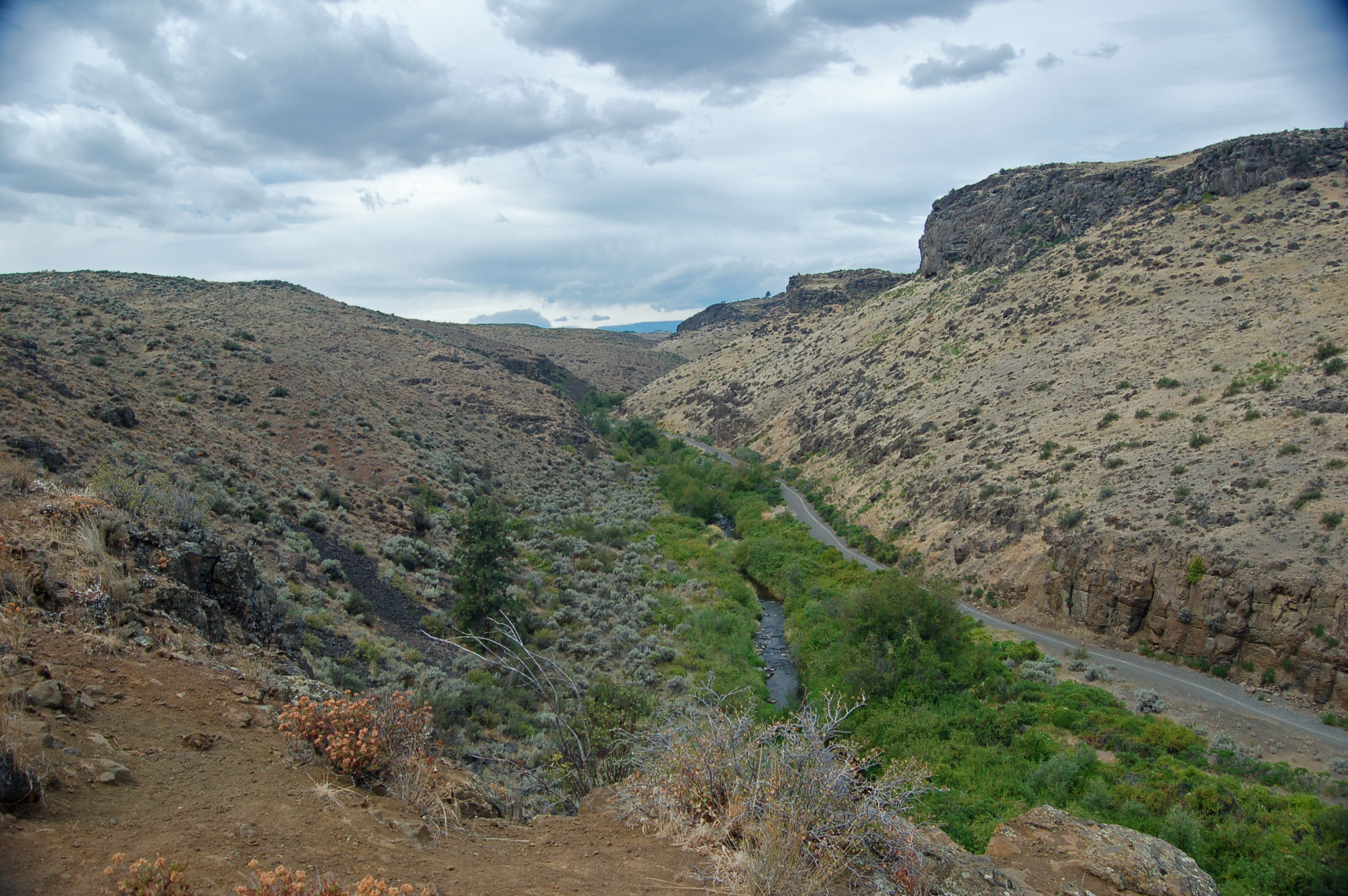
Just outside of Yakima, in central Washington, the Cowiche Canyon and adjacent uplands host nearly 900 acres of year-round opportunities for non-motorized outdoor recreation. Spring, Summer and Fall bring opportunities for hiking, trail-running and mountain biking the nearly 13 miles of unpaved trails. Skiers and other winter lovers can enjoy the gentle grade of the 2.9-mile Cowiche Canyon Trail, a former rail bed with eleven bridge crossings of Cowiche Creek. The Bureau of Land Management has partnered with the non-profit Cowiche Canyon Conservancy to provide access to this undeveloped natural landscape overlooking the city of Yakima.
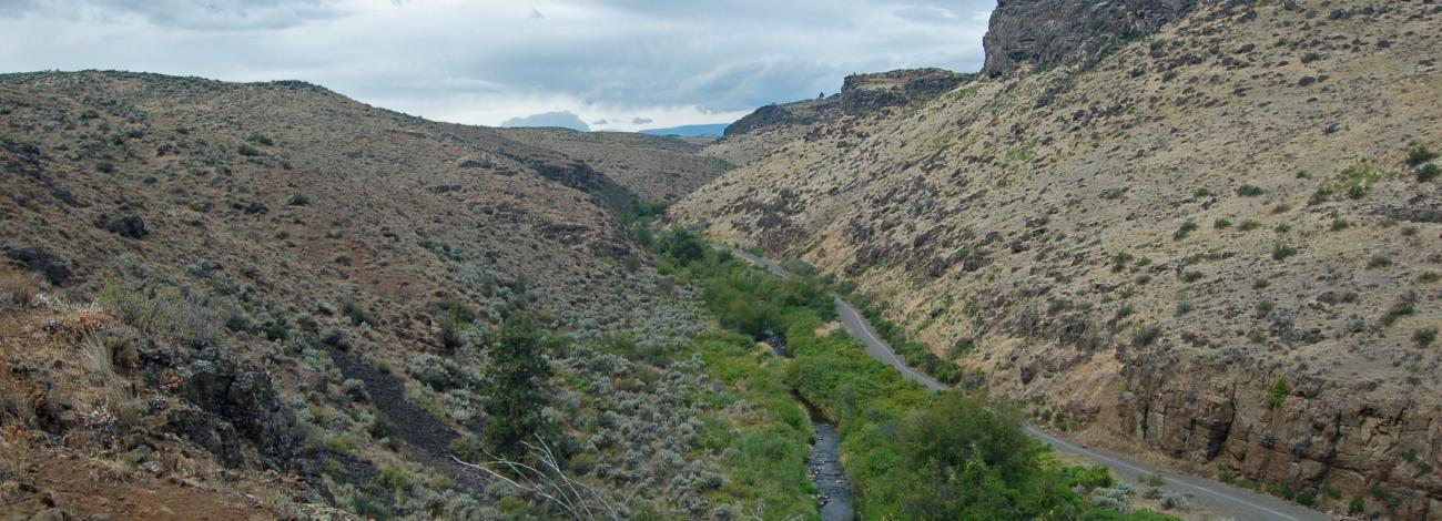
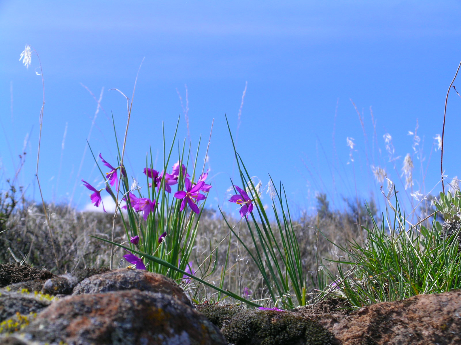
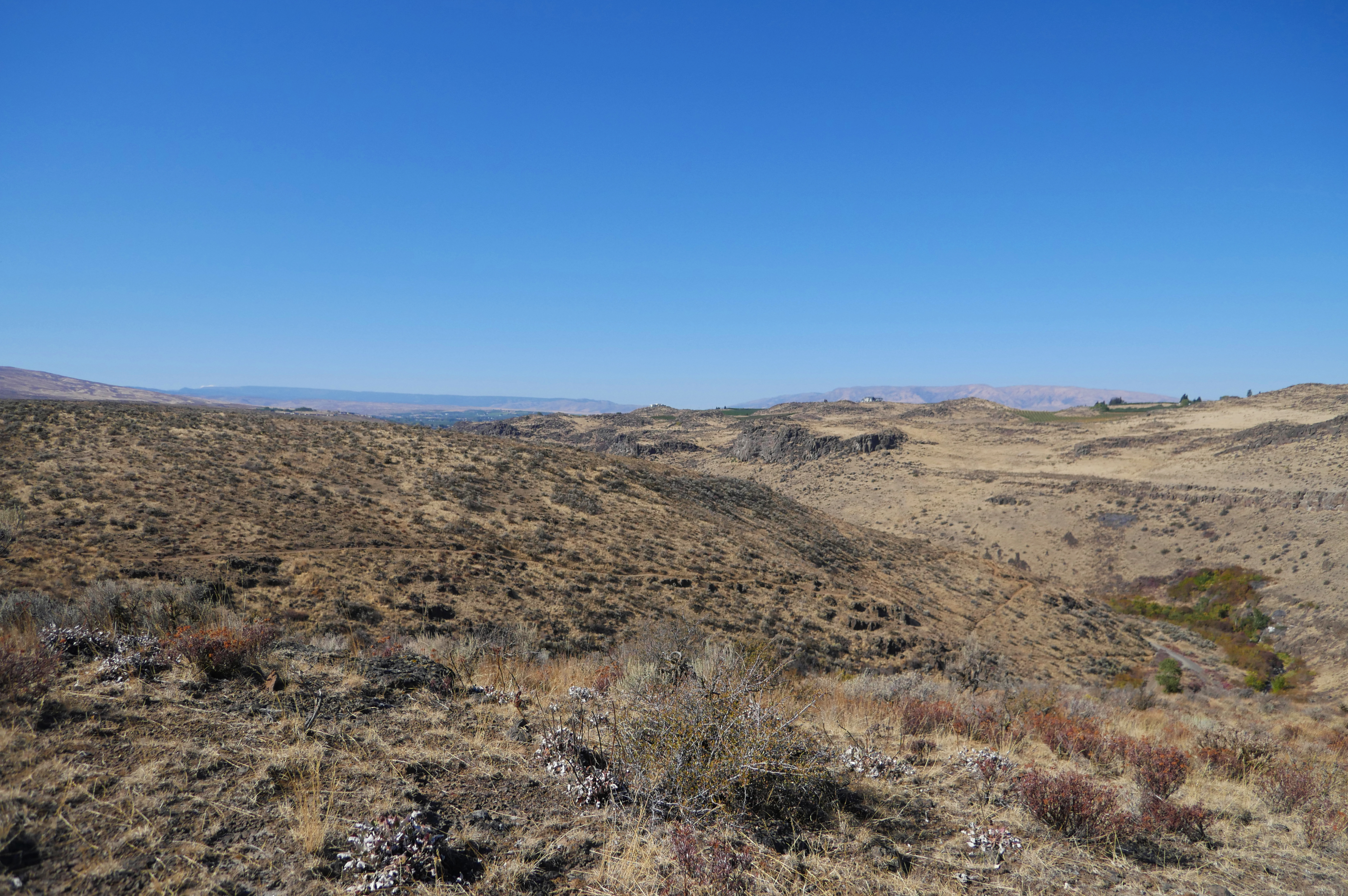
The Cowiche Canyon is characterized by towering walls consisting of two types of lava, 17.5 million-year-old Columbia River flood basalts and one million-year-old andesite, the latter originating at Goat Rocks volcano, some 35 air miles away. The uplands above the canyon offer wide open spaces and spectacular views of Yakima, Mt. Adams, and an amazing springtime wildflower display covering the fragile lithosol soil.
Summertime brings big contrasts to the Cowiche Canyon trail system. Upland plants of this shrub-steppe habitat like Desert Parsley, a biscuitroot, become dormant during drought months. In the neighboring Cowiche Creek riparian habitat, life abounds with more than 185 species of trees, shrubs and flowers and 125 bird species. Because of the area’s botanical richness, much of it is managed as an Area of Critical Environmental Concern (ACEC), a designation which provides a special emphasis on protecting this beautiful landscape.
Know Before You Go
- The Cowiche Canyon trail system is open for day-use only. Four small trailheads provide access to the area and almost 13 miles of unpaved trails. Trailer parking is available at the Cowiche Canyon railroad grade trailheads only; no trailer parking at the Summitview or Scenic Trailheads.
- Poison ivy is abundant in the riparian area along the creek; protect yourself and your pet when on the trail.
- The use of motorized vehicles, campfires, camping and firearm discharge is prohibited on Cowiche Canyon trail system lands.
- Dogs must be under control at all times on these busy trails. Please pick up after your pet!
Point of Interest
The Cowiche Canyon Trail was once the bed of the Burlington Northern Railroad, built in 1913, to haul apples from Cowiche and Tieton to fruit warehouses in Yakima. A few years before construction started, the area was described as a "…very rocky canyon ... which is absolutely worthless for any use whatever except for railroad purposes.” The railroad abandoned the line in 1984 and the Cowiche Canyon Conservancy was formed the following year to obtain the right of way and develop a trail for public use. In 1987 the railroad tracks and three rail bridges were removed.
Photos
Contact Us

Activities


Addresses
Directions
To Scenic Trailhead from downtown Yakima, WA: Take Summitview Ave to N 66th Ave., then turn right, driving 0.5 miles until Englewood Ave. Turn left on Englewood Ave. and proceed another 0.9 miles, turning right on N 80th Ave. Drive another 0.2 miles and turn left on Scenic Drive; the trailhead is 0.5 miles further on the right.
To Weikel Trailhead (for rail trail through Cowiche Canyon): Head west on Summitview Ave. In 7.1 miles, turn right onto N Weikel Rd. In 0.5 miles, turn right onto gravel road to parking lot. From parking lot, walk east along the gravel road past the house to the trailhead.
External Map
Fees
No Fees.