
BLM CO TRFO Weber & Menefee Mountains Wilderness Study Areas Map
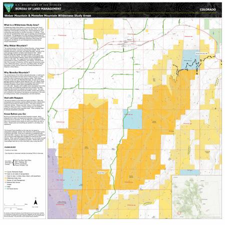
This map provides a geographic reference for the boundaries of the Weber Mountain & Menefee Mountain Wilderness Study Areas as well as educational interpretation of this special management designation. The intent of the map is to help visitors navigate the area and understand the unique qualities and sensitive nature of the WSA.
Download Files
Publication Date
Region
Tres Rios FO
Organization
Collection: Public Room
Category: Map
Keywords
Wilderness Study Area
Horseback Riding
Hiking
Fishing