
Sabinoso Wilderness
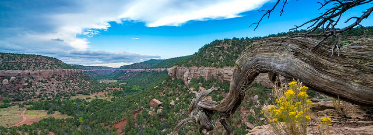
The Sabinoso Wilderness is a remote area in the northeastern portion of New Mexico. The Wilderness includes a series of high, narrow mesas surrounded by cliff-lined canyons. The rugged country primarily supports piñon pine and juniper woodlands with occasional clusters of ponderosa pine. A perennial warm season grass savanna is found on the mesa tops. Streams periodically flow in the canyon bottoms supporting riparian vegetation including willow and cottonwood. The deep canyon area, surrounded by the wide-open New Mexico plains, is unique for this region. The deep incisions cut by Cañon Olguin, Cañon Largo, and Lagartija Creek create a striking topographical and geological contrast in this otherwise flat terrain.
Frequently Asked Questions
How can I access the Cañon Ciruela donation?
- The Wilderness is surrounded by private ranches and roads. There is no public access points to the Cañon Ciruela portion of the Sabinoso Wilderness. The only the public access point is located on the southwest side of the Wilderness Area. No future access points are planned.
- All the areas outside of the wilderness boundary, except at the trailhead are private or State Lands. The State of New Mexico requires an annual recreation permit for access to State lands. Please respect the property rights of the owners that surround the Wilderness and the private parcels that are in-holdings within the Wilderness. Do not cross or use these lands on foot or by vehicle. Do not cut fences. Close gates behind you.
What is the weather/chance of floods?
- Please check the 7-Day Forecast 35.63N 104.5W (weather.gov).
What are the road conditions?
- There are 7 miles of maintained dirt road and then 3 miles of unmaintained road that travels through private property that is not passable when wet. Up-to-date road conditions are not available.
Where can I disperse camping with a vehicle or RV in the Wilderness?
- Primitive camping, at least ¼ mile from the trailhead, is allowed within the Wilderness. Building structures including lean-to’s are not permitted. Wilderness areas are closed to all motorized and mechanized use (bikes, drones, carts, vehicles). There is no dispersed camping in the area.
Do you need a permit?
- Backpacking does not require a permit. Permits are, however, required for commercial guiding, educational or organized groups, outfitting and filming.
How many miles of trail are there?
- There are no facilities within or adjacent to the Wilderness including trails or signage within the Wilderness. Pack It In/Pack It Out applies to trash and human waste. Please use Restops, Wag Bags or other portal toilet options.
Are campfires allowed?
- Campfires are allowed while backpacking use Leave No Trace Principles, unless under fire restrictions. Dead and down only. No campfires are allowed within or adjacent to the trailhead. It is the users responsibility to know if the area is under fire restrictions or if red flag warnings are in effect.
Is there cell phone coverage?
- There is no cell phone coverage.
Is there water available?
- Water is rare in this dry land and is not available much of the year.
- Only water from developed maintained systems at recreation sites is safe to drink. Open water sources are easily contaminated by human or animal waste. All water should be treated to prevent giardiasis. This intestinal parasite can leave you feeling miserable for weeks. Boiling your drinking water for 5 min is the best way to kill the organism.
Is hunting allowed?
- Hunting, managed by the New Mexico State Department of Game and Fish, is allowed within Sabinoso Wilderness. Sabinoso is in Big Game Management Unit 42.