
Missouri Breaks Monument Transportation Map available for hunters
Organization:
Media Contact:
(FORT BENTON, Mont.) – Hunters looking to feed their families or mount the next record-breaking trophy to their wall have their sights set on the heart of Montana.
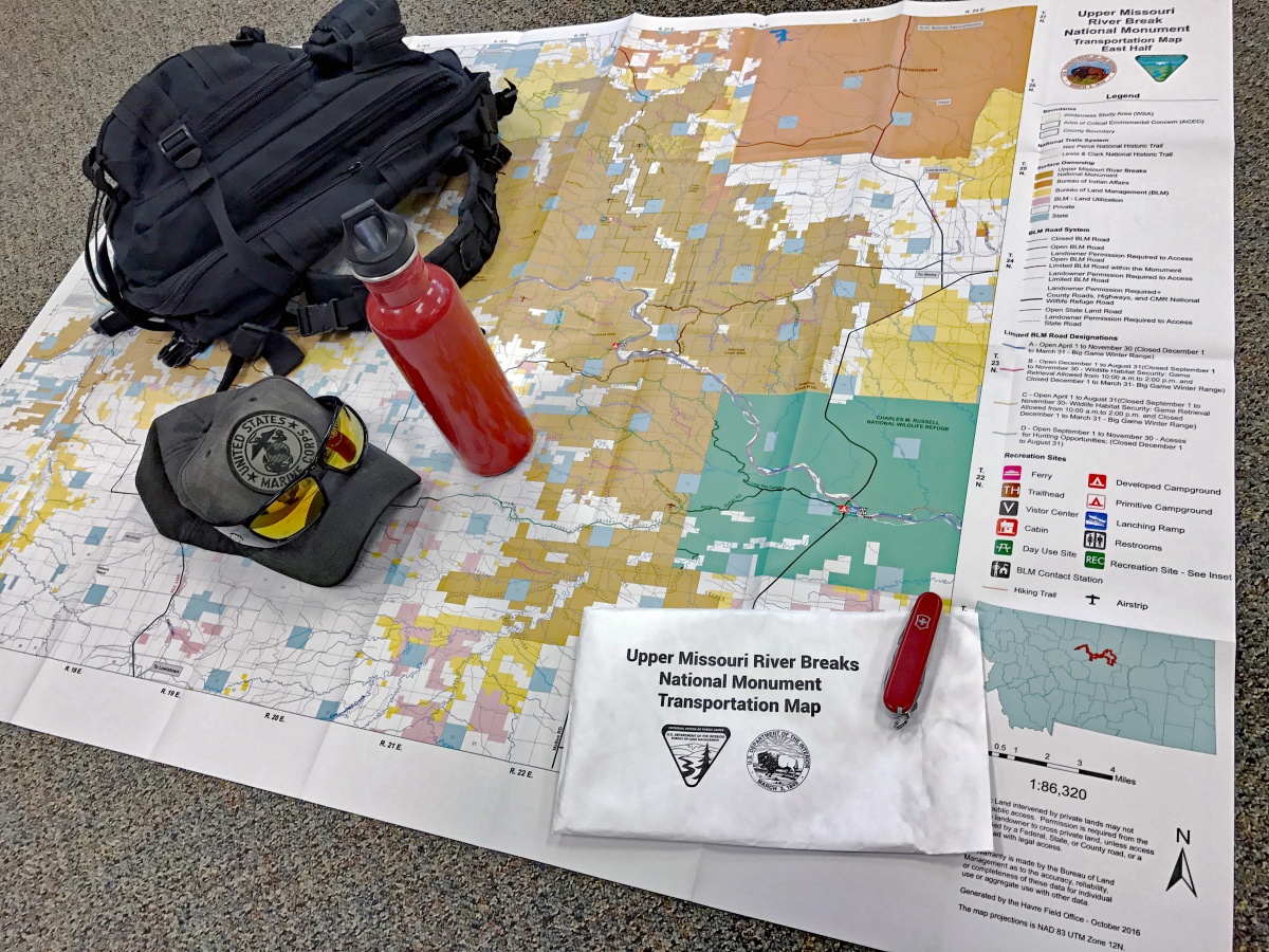
Monument Transportation Map will withstand
punishing conditions hunters encounter. The map
has detailed information, including the locations
of: primitive and developed campsites, hiking
trails, open roads, landing strips, boat ramps, land
ownership, day use sites and more.
(BLM photo Jonathan Moor)
Whether stalking or ambushing, the Upper Missouri River Breaks National Monument Transportation Map is a low-tech guide to access the best spots.
The must-have, rugged, waterproof Upper Missouri River Breaks National Monument Transportation Map will withstand punishing conditions hunters may encounter.
The map is packaged in a storage envelope made of the same highly durable, rip-resistant material as adventure race body numbers.
“Hunters can find detailed information about the Monument on the map, including locations of: primitive and developed campsites, hiking trails, open roads, landing strips, boat ramps, land ownership, day use sites and more,” said Upper Missouri River Breaks National Monument Manager Josh Chase.
The BLM strives to be a good neighbor in the communities we serve, where we provide opportunities for economic growth with space for traditional uses such as ranching, mining, logging, and energy development as well as hunting.
The Upper Missouri River Breaks National Monument attracts Americans searching for the opportunity to experience abundant wildlife and vast expanses of beauty, where many square-miles are free from any signs of human activity. Those same conditions also mean most of the Monument has no cell phone signal to call for help in times of trouble or disorientation. When GPS batteries fail, a quality map may be the only source to find the way out of the Monument.
Upper Missouri River Breaks National Monument Transportation Maps can be purchased for $10 at the Bureau of Land Management Offices in Havre and Lewistown, Mont.
The BLM manages about 245 million acres of public land located primarily in 12 western states, including Alaska, on behalf of the American people. The BLM also administers 700 million acres of sub-surface mineral estate throughout the nation. Our mission is to sustain the health, diversity, and productivity of America’s public lands for the use and enjoyment of present and future generations.