
Mapping drone to fly over July Fire area
Organization:
Media Contact:
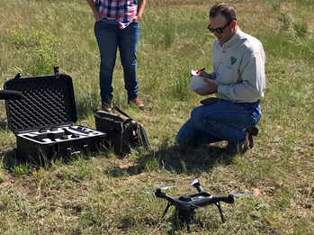
Chase prepares to launch a quadcopter drone to
take aerial pictures and video of public lands.
(BLM Photo by Jonathan Moor)
(MALTA, Mont.) – As time and weather progress, the area burned by the July Fire will likely experience changes and erosion.
In an effort to document the progression of these changes the Bureau of Land Management Malta Field Office is planning to conduct mapping drone flights Aug. 7-9, 2017.
The flights will establish a baseline using a quadcopter Unmanned Aerial System, commonly called a “drone,” weighing under 5 lbs. and capable of taking pictures and video, according to BLM Archaeologist Josh Chase, who will pilot the drone.
“We’ll be collecting soil and fire damage data to establish a baseline for an annual study and comparison of potential erosion and long-term fire effects on the area,” Chase explained.
Data collected during the flight will help BLM Malta Field Manager Tom Darrington make decisions about how to proceed with stabilization and recovery efforts for the affected area. “Public safety is our highest priority. As we evaluate the need for soil stabilization treatments, particularly above the town of Landusky, UAS flights will allow us to assess areas most severely affected by the fire and focus on areas most in need of stabilization treatments. The data from UAS flights can also help measure success of these treatments in subsequent years.”
Due to its size, the rechargeable battery-powered drone can operate more safely and with significantly less cost to American taxpayers than a manned aircraft.
The BLM respects the ties that native and traditional communities have to public lands in the Little Rocky Mountains. The BLM is committed to making America great through shared conservation. The BLM strives to be a good neighbor in the communities we serve, where we provide opportunities for economic growth with space for traditional uses such as ranching, mining, and logging, and energy development as well as hunting and fishing. As stewards, the BLM manages public lands for the benefit of current and future generations, supporting conservation as we pursue our multiple-use mission.
– BLM –
The BLM manages about 245 million acres of public land located primarily in 12 western states, including Alaska, on behalf of the American people. The BLM also administers 700 million acres of sub-surface mineral estate throughout the nation. Our mission is to sustain the health, diversity, and productivity of America’s public lands for the use and enjoyment of present and future generations.