
The BLM encourages public to track the bloom responsibly on public lands in the California Desert
Organization:
BLM Office:
Media Contact:
PALM SPRINGS, Calif. – The Bureau of Land Management encourages the public to recreate responsibly, plan ahead and know before you go when viewing wildflowers on public lands in the California desert.
The desert ecosystems are fragile, and plants can be easily destroyed if walked on or run over by a vehicle. Stay on trails, roadsides and other hard surfaces and park in designated areas to prevent damage to plants or animal habitats. Leave what you find and never pick or uproot plants.
Here are some places to view wildflowers on BLM-managed public lands in the California desert:
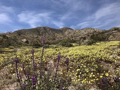
Mojave Trails National Monument: Downloadable PDF Map and Interactive Online Map
- Amboy Crater: An accessible and spectacular view with a moderately challenging trail up to and around the crater’s rim. Mild bloom expected this season. Recommended to hike in the early morning and carry several gallons of water. Amboy Crater is closed during peak summer months due to extreme heat. Please review the tips section on page 2 of this news release for important information about visiting Amboy Crater.
- Goffs Schoolhouse: The Mojave Desert Heritage and Cultural Association maintains a small desert garden adjacent to its historic schoolhouse.
- Bonanza Springs Watchable Wildlife Area: An off-highway experience and one of only three places where the Mojave River flows above ground year-round in the Mojave Desert. Four-wheel drive vehicles with a high clearance are needed.
- Afton Canyon: One of the few natural watering areas for desert flora and fauna. Four-wheel drive vehicles with a high clearance are needed.
- Mojave Road running through Piute Valley in the eastern portion of the Monument and Afton Canyon in the west: Off-highway experience.
- Amboy Road, north of Twentynine Palms, where the road borders the Sheephole Valley Wilderness: Use Owlshead GPS or look for one of several dirt pull offs where visitors can park a vehicle along the western boundary of the wilderness. A walk east into the wilderness yields modest, but diverse desert blooms in the washes at the base of the mountains. (Caution: designated off-highway vehicle routes in this area can become extremely sandy and should only be attempted in vehicles designed for this purpose).
- Snaggletooth Primitive RV Camp: While the campground is not blooming dramatically this season, those with four-wheel drive and high clearance vehicles can continue along designated routes north of the campground to see desert blooms.
The BLM manages about 245 million acres of public land located primarily in 12 western states, including Alaska, on behalf of the American people. The BLM also administers 700 million acres of sub-surface mineral estate throughout the nation. Our mission is to sustain the health, diversity, and productivity of America’s public lands for the use and enjoyment of present and future generations.