
Escalante Triangle Mountain Biking Area Map
Overview
The Dominguez-Escalante National Conservation Area (D-E NCA) is part of the BLM’s National Conservation Lands. It is located in western Colorado, about 10 miles south of Grand Junction. The southwest boundary of the NCA planning area borders the Uncompahgre National Forest. The northwest boundary runs along Colorado Highway 141 and includes approximately 10 miles of the Tabeguache-Unaweep Scenic and Historic Byway. The northeastern boundary is defined by U.S. Highway 50 and adjacent private lands, while the southeastern boundary is defined by Delta-Nucla (25 Mesa) Road, which runs south to the national forest boundary. Elevations within the NCA range from approximately 4,700 feet to over 8,200 feet above sea level, resulting in great biological, geological, and topographical diversity.
Recreation
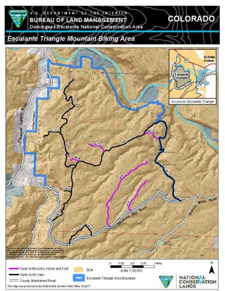
The 2017 D-E NCA Resource Management Plan designated the Escalante Triangle as an area for development of a non-motorized loop trail system designed for mountain bikes. Planning is beginning for a new trail system that meets these goals. The map shows the network of existing designated routes in the Escalante Triangle and the type of use each route is designated for. All motorized and bicycle travel is limited to designated routes.