
Dolores River Special Recreation Management Area Map
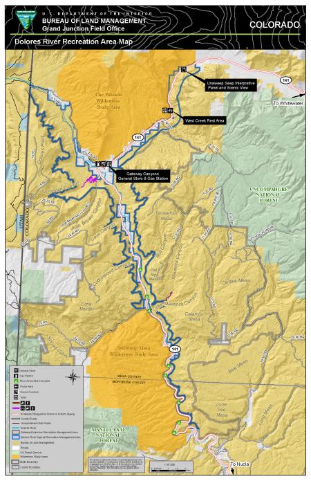
The Dolores River SRMA encompasses scenic canyon country along the lower Dolores River west to the Utah border, portions of West creek, and lands adjacent to the Town of Gateway. It also includes a portion of the Unaweep-Tabeguache Scenic and Historic Byway.
Download Files
Publication Date
Region
Colorado
Grand Junction FO
Organization
Collection: Public Room
Category: Map
Keywords
Mountain Biking
Camping
Hiking
Geology
Boating
Dolores River Canyon