
Oregon River Trip Planning Just Got Easier
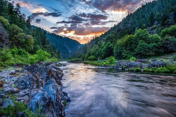
PORTLAND, Ore. — Oregon river information is now more accessible than ever on the National Rivers Project’s recreational river map. In collaboration with the Bureau of Land Management, the River Management Society recently added or updated over 1,000 miles of Oregon rivers to the NRP website. This includes nearly 700 miles of Wild and Scenic Rivers, iconic whitewater reaches, and beginner-friendly sections.
“Whether you want to paddle through Oregon’s high deserts and canyons or explore the rainforests and coastal waterways, the National Rivers Project is a really convenient first stop in the planning process,” says David Ballenger, BLM Oregon/Washington Recreation Lead.
The NRP website offers intuitive search features for both beginners and experienced paddlers. Users can sort sections by difficulty and recreational amenities such as fishing, camping and boat ramps. Each listing provides river access and permit details, with links to more information.
“Recreating on Oregon rivers gives people a stronger sense of stewardship,” says Lauren Pidot, BLM Oregon/Washington National Conservation Lands Program Lead. “Visitors are interested in protecting these public resources. We’re excited to help people more easily find these opportunities.”
Some of the recently added sections are very accessible with developed launches, while others are more wild and remote. BLM rangers remind boaters to check local weather conditions, water levels and permit requirements before departing on a river trip.
“All of our river and access information is sourced and reviewed by managing agencies, so boaters can feel confident when they begin their trip planning on our website,” says James Major, NRP Coordinator. “We want to give special thanks to BLM Oregon for their invaluable assistance on this project.”
The BLM manages about 245 million acres of public land located primarily in 12 western states, including Alaska, on behalf of the American people. The BLM also administers 700 million acres of sub-surface mineral estate throughout the nation. Our mission is to sustain the health, diversity, and productivity of America’s public lands for the use and enjoyment of present and future generations.