Umpqua Site
| BLM District | Roseburg (Oregon) | BLM Field Office | South River |
| Congressional District | Oregon 4th | AMLIS # | OR105800001 |
| State Office Contact | John Barber | HUC # /Subbasin | 17100302 |
| Field Office Contact | Eric Heenan | Specific Watershed | South Umpqua |
| Location | Approximately 6 miles from the confluence of Deadman Creek and the South Umpqua River; Oregon (T29S, R2W, Sec 34, NENW, Willamette Meridian, UTM E 505500, UTM N 4762600, Lat. 43.016056, Long. -122.932503) |
||
| Land Ownership | Until recently, the two mines were believed to be located on private (patented) land. An abandoned mine land inventory was conducted by the Roseburg District in late 1996. This inventory, using Global Positioning System equipment, determined that the processing portion of the Umpqua Mine is on BLM-managed land. | ||
| Estimated Cost | $625,000 | ||
| Other Agency Links | Oregon Dept. of Environmental Quality | ||
| Google Earth | Click here for map | ||
The Umpqua site consists of two abandoned mine and a mercury retort mill facility (approximately 2 acres) constructed in the early 1900s. The site is located near the headwaters of a tributary to Deadman Creek and thence to the South Umpqua River. The mill facility is situated on lands administered by the BLM. Some of the material mined from the adjacent Maud S. mine was processed at the Umpqua site after the mill was built. The two mines are located approximately 1,600 feet apart with the Maud S. approximately 400 feet higher in elevation. Both operations consisted of mining, milling, and processing of cinnabar (Hgs), including distillation and amalgamation, into mercury. Development of the mines began in the early 1920s with most of the production occurring in the late 1920s and early 1930s although the Umpqua mine produced until 1943. There has been no known mining activity at these mines since 1943. Mine adits, ore car rails, hoppers, both rotary and brick furnaces, and amalgamation plants remain abandoned at the sites.
Mercury concentrations are of concern downstream of the site and exceed BLM Human Risk Management Criteria (HRMC) by as much as 20 times. Several removal actions have been accomplished with studies planned for soil characterization and off-site disposal of mercury contaminated wastes. The Oregon Department of Environmental Quality (ODEQ) is developing a regional clean-up plan for mercury contaminated sites, including the Umpqua mines and mill. BLM is cooperating in this effort.
The State of Oregon has designated all tributaries to the South Umpqua River, a Tier 1 Key Watershed and habitat for cutthroat trout and salmon, as a public and private domestic water supply (with adequate pre-treatment and natural quality to meet drinking water standards) suitable for:
- Industrial Water Supply
- Irrigation
- Livestock Waterin
- Anadromous Fish Passage
- Salmonid Fish Rearing
- Salmonid Fish Spawning
- Resident Fish and Aquatic Life
- Wildlife and Hunting
- Fishing
- Boating
- Water Contact Recreation
- Aesthetic Quality
Mitigation of this site will require the removal, and disposal of mercury contaminated material. To date, debris from dismantled structures has been segregated for disposal at appropriate facilities and some sampling and mapping of contaminants has been completed. Survey drawings and photographs of the site have been taken. An access gate was installed 1/2 mile from the site to in an effort to manage human exposure. CERCLA authorities have been implemented with the objective of removing contaminated waste material from the site in order to eliminate human and environmental health threats. Removal Actions taken to date include: development of a public involvement plan with associated news releases, public meetings, and community updates; screening for a Primary Responsible Party (PRP); completion of a preliminary Site Assessment and Engineering Evaluation/Cost Analysis (EE/CA); design of a Removal Action for off-site disposal; signing of an Action Memorandum and implementation of limited on-the-ground Removal Action in FY 2004; and establishment of a publically available Administrative Record.
Ongoing work will focus on: removal of previously segregated contaminated materials to the appropriate facilities; identifying and characterizing the nature and extent of additional environmental contamination at the site; and monitoring the site to determine the effectiveness of the removal actions. Off-site disposal will allow BLM to design a comprehensive plan to meet both RAOs and ARARs for this project. There is a high feasibility that the Removal Action will eliminate contaminant mobility by largely removing the highest risk media sources, primarily mercury-contaminated soils and debris, and placing these wastes into a permitted off-site disposal facility.
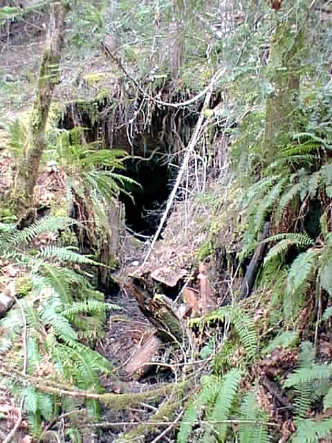 |
The main adit at the Umpqua AML site has been collapsing and the opening has now moved to the property line. |
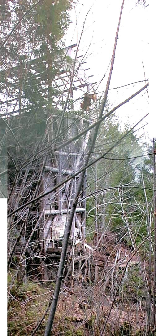 |
Mined ore was transported from the adit to hopper. From here the ore was crushed and placed on a conveyor for transport to the rotary furnace. The conveyor has recently been damaged by vandals. |
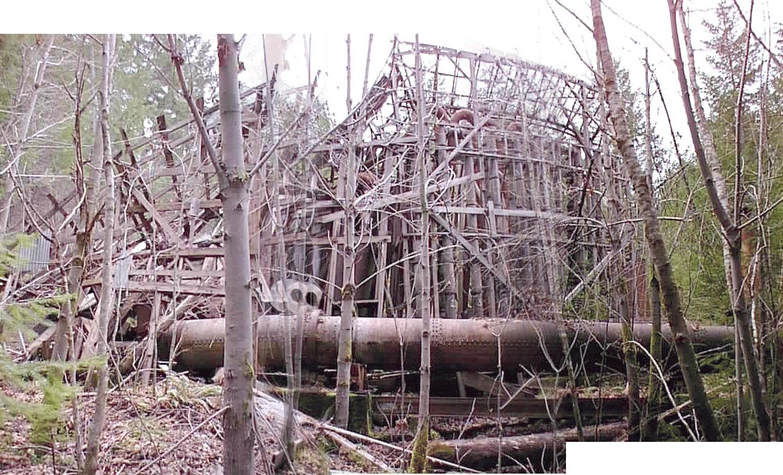 |
The crushed ore was processed in the rotary furnace (foreground) and then distilled in the amalgamation plant (behind) into mercury. It is estimated that nine 76lb. flasks of mercury were produced from this plant; a relatively small amount compared to the 39,500 flasks produces at the Bonanza mine, also located within Douglas County. |