Kaaba/Texas Mine
| BLM District | Spokane (Washington) | BLM Field Office | |
| Congressional District | Washington 4th | AMLIS # | WA134800003 |
| State Office Contact | HUC # /Subbasin | 170200070101 | |
| Field Office Contact | Specific Watershed | Similkameen River | |
| Location | Township 40 N., Range 25 E., Sections 14 and 23, Willamette Meridian. Latitude 48 57' 21.0" north, Longitude 119 38' 57.0" west | ||
| Land Ownership | Project area is about 33.7 % public domain (BLM), about 58.4% private, and about 7.8% State-owned land. Total size of the project area is about 12.7 acres. | ||
| Estimated Cost | |||
| Other Agency Links | |||
| Google Earth | |||
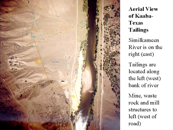
AML clean water/CERCLA issues; under State Model Toxics Control Act, it is a high-priority (ranked 1) site for Washington State. The former tailings site adjoined the Similkameen River, was actively eroded, and was occasionally inundated by flood waters.
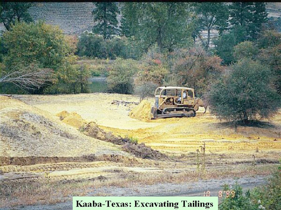
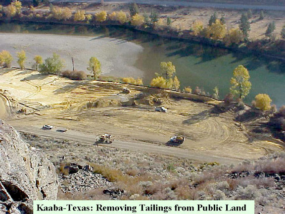
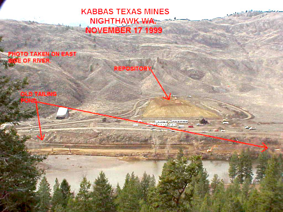
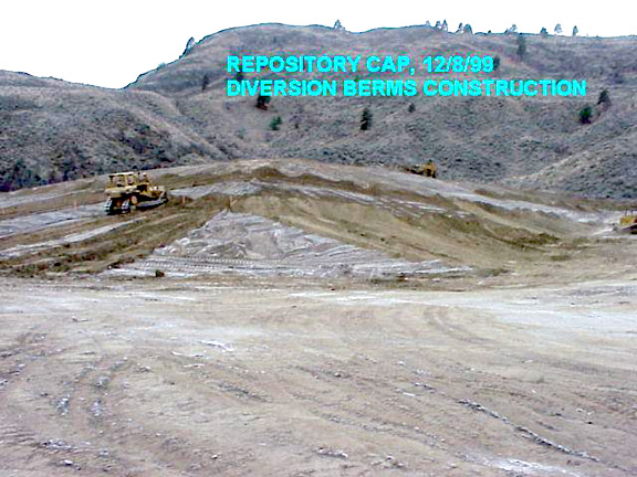
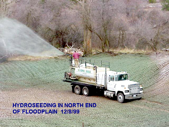
The Kaaba/Texas mine operated intermittently from 1915 through 1950 under a variety of owners, with production from a mill on private land (patented claims). During the early years, it appears that tailings were discharged directly to the Similkameen River. In 1945-1946, a Washington State Pollution Control Hearings Board investigation of pollution from the mine entering the river led to the mining company constructing tailings-settling basins. These basins subsequently deposited tailings onto public lands. In 1984, the Environmental Protection Agency (EPA) conducted a site inspection to evaluate potential contaminant effects of the tailings on the adjacent river. At about the same time, the U.S. Army Corps of Engineers sampled the tailings as part of a study to evaluate the possible impact of a dam construction downstream from the site. The BLM conducted several studies (macro-invertebrate studies: BLM - 1987, 1988, 1994; water and sediment quality: U.S. Geological Survey - 1994) to evaluate the impacts of the mine tailings on water and sediment quality and aquatic biota for assessment of corrective actions. In 1989, the BLM started determinations of the complex land-ownership boundaries at this site and initiated actions with the State regarding cleanup on the predominantly private site. From 1995 through 1999, the BLM conducted a characterization and removal site-evaluation and prepared an Engineering Evaluation/Cost Analysis to evaluate possible corrective measures, including an on-site repository. In 1999 and 2000, the EPA and the BLM jointly funded the site clean-up. The EPA conducted the design work and, in consultation with the BLM and the Washington Department of Ecology, administered the excavation/construction contract to remove the tailings from the bench adjacent to the river, place them in a repository developed on private land, and cap and reclaim the repository. During 2000, the BLM closed some adits on public lands and installed bat gates in others. The BLM will be completing some surface revegetation work on public lands.