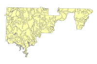
Recreation Opportunity Spectrum Inventory

Data format: ArcInfo Coverage

File or table name: ros_inv03

Coordinate system: Universal Transverse Mercator

Theme keywords: Bureau of Land Management, BLM, National Park Service, NPS, recreation, recreation settings, social settings, physical settings, administrative settings, recreation inventory, ROS, urban, rural, roaded natural, semi-primitive motorized, semi-primitive non-motorized, primitive

Abstract: This data set represents the broad-brush inventory of recreation settings, compositing the physical, social and administrative components, of the Arizona Strip Field Office, Parashant and Vermilion. The polygons depict a range of recreation settings that include Urban, Rural, Roaded Natural, Semi-Primitive Motorized, Semi-Primitive Non-Motorized, and Primitive.

FGDC and ESRI Metadata:

Metadata elements shown with blue text are defined in the Federal Geographic Data Committee's (FGDC) Content Standard for Digital Geospatial Metadata (CSDGM). Elements shown with green text are defined in the ESRI Profile of the CSDGM. Elements shown with a green asterisk (*) will be automatically updated by ArcCatalog. ArcCatalog adds hints indicating which FGDC elements are mandatory; these are shown with gray text.

Identification Information:


Citation:
Citation information:
Originators: David Kiel, Bureau of Land Management, Arizona Strip District Office (BLM-ASDO)


Title:
Recreation Opportunity Spectrum Inventory
*File or table name: ros_inv03


Publication date: 200511
*Geospatial data presentation form: vector digital data


Publication information:
Publication place: St. George, Utah
Publisher: BLM-ASDO

Other citation details:
The data set was developed as part of a land-use planning effort.


Online linkage: http://www.blm.gov/az/st/en/prog/maps/gis_files.html#strip


Description:
Abstract:
This data set represents the broad-brush inventory of recreation settings, compositing the physical, social and administrative components, of the Arizona Strip Field Office, Parashant and Vermilion. The polygons depict a range of recreation settings that include Urban, Rural, Roaded Natural, Semi-Primitive Motorized, Semi-Primitive Non-Motorized, and Primitive.

Purpose:
The data set is intended to be used as a tool for resource management planning and the day-to-day management evaluating the effects of resource use proposals on existing recreation settings. For regional analysis and display at 1:24,000.  This dataset was prepared/acquired for use in the ASDO resource management planning process.

Supplemental information:
Dataset locally known as ros_inv03.  This dataset and other datasets in the Arizona Strip District Office Geographic Information Database (ASDOGID) represent data for the BLM Arizona Strip District Office, and may include the Arizona Strip Field Office, Vermilion Cliffs National Monument (VCNM) and/or the Grand Canyon-Parashant National Monument (GCPNM or PARA).  The Grand Canyon-Parashant National Monument is managed jointly by the BLM and the National Park Service (NPS).

*Language of dataset: en


Time period of content:
Time period information:
Single date/time:
Calendar date: 200511

Currentness reference:
ground condition

Status:
Progress: In work
Maintenance and update frequency: Annually

Spatial domain:
Bounding coordinates:
*West bounding coordinate: -114.114989
*East bounding coordinate: -111.521972
*North bounding coordinate: 37.042078
*South bounding coordinate: 35.816357

Local bounding coordinates:
*Left bounding coordinate: 222811.130511
*Right bounding coordinate: 452869.381490
*Top bounding coordinate: 4099671.560738
*Bottom bounding coordinate: 3967925.255810

Keywords:
Theme:
Theme keywords: Bureau of Land Management, BLM, National Park Service, NPS, recreation, recreation settings, social settings, physical settings, administrative settings, recreation inventory, ROS, urban, rural, roaded natural, semi-primitive motorized, semi-primitive non-motorized, primitive
Theme keyword thesaurus: None

Theme:
Theme keyword thesaurus: ISO 19115

Theme:
Theme keyword thesaurus: BLM-Theme

Place:
Place keywords: Arizona
Place keyword thesaurus: BLM-State

Place:
Place keywords: Arizona Strip, Arizona Strip District Office, Arizona Strip Field Office, Grand Canyon-Parashant National Monument, Vermilion Cliffs National Monument
Place keyword thesaurus: None

Access constraints: Discretionary, contains no sensitive information - generally considered releasable.
Use constraints:
This data should not be used at a scale larger than 1:24,000.  The data and corresponding attributes are only as accurate as the source maps from which they were obtained, and may vary depending on the data and method of acquisition.

This data is suitable for regional planning, management decision support at intermediate scales (i.e. 1:24,000 or smaller), and cartographic purposes.  The data is not suitable for analysis at scales larger than 1:24,000.

If the Receiving Agency (RA) has modified the data in any way, they are obligated to describe the types of modifications they have performed on hardcopy maps utilizing the data.  RA specifically agrees not to misrepresent ASDOGID datasets or to imply that any changes made were approved by BLM ASDO or NPS.

No warranty is made by the BLM/NPS for use of the data for purposes not intended by BLM/NPS.  This information may be updated without notification.

Point of contact:
Contact information:
Contact person primary:
Contact person: Marisa Monger
Contact organization: Bureau of Land Management, Arizona Strip District Office (BLM-ASDO)
Contact position: GIS Specialist


Contact address:
Address type: mailing and physical address
Address:
345 East Riverside Dr.
City: St. George
State or province: Utah
Postal code: 84790
Country: USA

Contact voice telephone: (435)688-3283
Contact TDD/TTY telephone: (435)688-3200
Contact facsimile telephone: (435)688-3258


Contact electronic mail address: mmonger@blm.gov


Hours of service: 8:00 am to 4:30 pm
Contact instructions:
Please use email to contact.

*Native dataset format: ArcInfo Coverage
*Native data set environment:
Microsoft Windows 2000 Version 5.1 (Build 2600) Service Pack 2; ESRI ArcCatalog 8.3.0.800


Cross reference:
Citation information:
Originators: Bureau of Land Management, Arizona Strip District Office (BLM-ASDO)


Title:
Draft Resource Management Plan, Arizona Strip Field Office


Publication date: 20070302
Geospatial data presentation form: vector digital data


Publication information:
Publication place: St. George, Utah
Publisher: U.S. Government

Online linkage: http://www.blm.gov/az/st/en/info/nepa/environmental_library/arizona_resource_management.html


Back to Top
Data Quality Information:


Attribute accuracy:
Attribute accuracy report:
Feature attributes were taken from source material.  Code assignments are believed to be representative of the source document.

Logical consistency report:
Data was reviewed for correct topological structure.  Duplicate lines have been removed.

Completeness report:
This dataset covers the entire BLM Arizona Strip District.  It is constantly being reviewed and added to as additional information becomes available.

Positional accuracy:
Horizontal positional accuracy:
Horizontal positional accuracy report:
The data has been vertically integrated to the Arizona BLM Geographic Coordinate Database (GCDB) and to 1:24,000 scale DLG base data, including transportation, hydrology, and powerlines where appropriate.  Overall horizontal accuracy for this data is not greater than national mapping accuracy standards (NMAS) for USGS source maps.  Snapping and coordinate shift tolerances were maintained at 0.01 meters or less through editing.  Horizontal positional accuracy for the digital data set was tested by visual comparison of the source data with hard copy verification plots.

Lineage:
Process step:
Process description:
Based on the need to inventory recreation settings for planning, a broad-brush evaluation and identification of settings was created using criteria found in the BLM Handbook 8310 Recreation Inventory, Chapter VI.

Process date: 2005


Process contact:
Contact information:
Contact organization primary:
Contact person: Tom Folks
Contact organization: Arizona Strip District Office, BLM
Contact position: Outdoor Recreation Planner


Contact address:
Address type: mailing and physical address
Address:
345 East Riverside Drive
City: St. George
State or province: UT
Postal code: 84790
Country: USA

Contact voice telephone: (435) 688-3264


Process step:
Process description:
Data file is created and stored in a master file in the computer system

Process software and version: ESRI ArcGIS 8.3


Process contact:
Contact information:
Contact organization primary:
Contact person: Marisa Monger
Contact organization: Arizona Strip District Office, BLM
Contact position: GIS Specialist


Contact address:
Address type: mailing and physical address
Address:
345 East Riverside Drive
City: St. George
State or province: UT
Postal code: 84790
Country: USA

Contact voice telephone: (435) 688-3283


Cloud cover: Unknown
Back to Top
Spatial Data Organization Information:


*Direct spatial Rreference method: Vector


Point and vector object information:
SDTS terms description:
*Name: arc
*SDTS point and vector object type: Complete chain
*Point and vector object count: 990

SDTS terms description:
*Name: label
*SDTS point and vector object type: Label point
*Point and vector object count: 289

SDTS terms description:
*Name: polygon
*SDTS point and vector object type: GT-polygon composed of chains
*Point and vector object count: 289

SDTS terms description:
*Name: tic
*SDTS point and vector object type: Point
*Point and vector object count: 4

ESRI terms description:
*Name: arc
*ESRI feature type: Simple
*ESRI feature geometry: Arc
*ESRI topology: FALSE
*ESRI feature count: 990
*Spatial index: FALSE
*Linear referencing: FALSE


ESRI terms description:
*Name: label
*ESRI feature type: Simple
*ESRI feature geometry: Label
*ESRI topology: FALSE
*ESRI feature count: 289
*Spatial index: FALSE
*Linear referencing: FALSE


ESRI terms description:
*Name: polygon
*ESRI feature type: Simple
*ESRI feature geometry: Polygon
*ESRI topology: TRUE
*ESRI feature count: 289
*Spatial index: FALSE
*Linear referencing: FALSE


ESRI terms description:
*Name: tic
*ESRI feature type: Simple
*ESRI feature geometry: Tic
*ESRI topology: FALSE
*ESRI feature count: 4
*Spatial index: FALSE
*Linear referencing: FALSE


Back to Top
Spatial Reference Information:


Horizontal coordinate system definition:
Coordinate system name:
*Projected coordinate system name: NAD_1983_UTM_Zone_12N
*Geographic coordinate system name: GCS_North_American_1983

Planar:
Grid coordinate system:
*Grid coordinate system name: Universal Transverse Mercator
Universal Transverse Mercator:
*UTM zone number: 12
Transverse mercator:
*Scale factor at central meridian: 0.999600
*Longitude of central meridian: -111.000000
*Latitude of projection origin: 0.000000
*False easting: 500000.000000
*False northing: 0.000000

Planar coordinate information:
*Planar coordinate encoding method: coordinate pair
Coordinate representation:
*Abscissa resolution: 0.000512
*Ordinate resolution: 0.000512
*Planar distance units: meters

Geodetic model:
*Horizontal datum name: North American Datum of 1983
*Ellipsoid name: Geodetic Reference System 80
*Semi-major axis: 6378137.000000
*Denominator of flattening ratio: 298.257222

Back to Top
Entity and Attribute Information:


Detailed description:
*Name: ros_inv03.aat


Entity type:
*Entity type label: ros_inv03.aat
*Entity type type: Feature Class
*Entity type count: 990

Attribute:
*Attribute label: FID
*Attribute alias: FID
*Attribute definition:
Internal feature number.
*Attribute definition source:
ESRI

*Attribute type: OID
*Attribute width: 4
*Attribute precision: 0
*Attribute scale: 0


Attribute domain values:
*Unrepresentable domain:
Sequential unique whole numbers that are automatically generated.


Attribute:
*Attribute label: Shape
*Attribute alias: Shape
*Attribute definition:
Feature geometry.
*Attribute definition source:
ESRI

*Attribute type: Geometry
*Attribute width: 0
*Attribute precision: 0
*Attribute scale: 0


Attribute domain values:
*Unrepresentable domain:
Coordinates defining the features.


Attribute:
*Attribute label: FNODE#
*Attribute definition:
Internal node number for the beginning of an arc (from-node).
*Attribute definition source:
ESRI

*Attribute type: Binary
*Attribute width: 4
*Attribute output width: 5


Attribute domain values:
*Unrepresentable domain:
Whole numbers that are automatically generated.


Attribute:
*Attribute label: TNODE#
*Attribute definition:
Internal node number for the end of an arc (to-node).
*Attribute definition source:
ESRI

*Attribute type: Binary
*Attribute width: 4
*Attribute output width: 5


Attribute domain values:
*Unrepresentable domain:
Whole numbers that are automatically generated.


Attribute:
*Attribute label: LPOLY#
*Attribute definition:
Internal node number for the left polygon.
*Attribute definition source:
ESRI

*Attribute type: Binary
*Attribute width: 4
*Attribute output width: 5


Attribute domain values:
*Unrepresentable domain:
Whole numbers that are automatically generated.


Attribute:
*Attribute label: RPOLY#
*Attribute definition:
Internal node number for the right polygon.
*Attribute definition source:
ESRI

*Attribute type: Binary
*Attribute width: 4
*Attribute output width: 5


Attribute domain values:
*Unrepresentable domain:
Whole numbers that are automatically generated.


Attribute:
*Attribute label: LENGTH
*Attribute definition:
Length of feature in internal units.
*Attribute definition source:
ESRI

*Attribute type: Float
*Attribute width: 8
*Attribute output width: 18
*Attribute number of decimals: 5


Attribute domain values:
*Unrepresentable domain:
Positive real numbers that are automatically generated.


Attribute:
*Attribute label: ROS_INV03#
*Attribute definition:
Internal feature number.
*Attribute definition source:
ESRI

*Attribute type: Binary
*Attribute width: 4
*Attribute output width: 5


Attribute domain values:
*Unrepresentable domain:
Sequential unique whole numbers that are automatically generated.


Attribute:
*Attribute label: ROS_INV03-ID
*Attribute definition:
User-defined feature number.
*Attribute definition source:
ESRI

*Attribute type: Binary
*Attribute width: 4
*Attribute output width: 5


Detailed description:
*Name: ros_inv03.pat


Entity type:
*Entity type label: ros_inv03.pat
*Entity type type: Feature Class
*Entity type count: 289

Attribute:
*Attribute label: FID
*Attribute alias: FID
*Attribute definition:
Internal feature number.
*Attribute definition source:
ESRI

*Attribute type: OID
*Attribute width: 4
*Attribute precision: 0
*Attribute scale: 0


Attribute domain values:
*Unrepresentable domain:
Sequential unique whole numbers that are automatically generated.


Attribute:
*Attribute label: Shape
*Attribute alias: Shape
*Attribute definition:
Feature geometry.
*Attribute definition source:
ESRI

*Attribute type: Geometry
*Attribute width: 0
*Attribute precision: 0
*Attribute scale: 0


Attribute domain values:
*Unrepresentable domain:
Coordinates defining the features.


Attribute:
*Attribute label: AREA
*Attribute definition:
Area of feature in internal units squared.
*Attribute definition source:
ESRI

*Attribute type: Float
*Attribute width: 8
*Attribute output width: 18
*Attribute number of decimals: 5


Attribute domain values:
*Unrepresentable domain:
Positive real numbers that are automatically generated.


Attribute:
*Attribute label: PERIMETER
*Attribute definition:
Perimeter of feature in internal units.
*Attribute definition source:
ESRI

*Attribute type: Float
*Attribute width: 8
*Attribute output width: 18
*Attribute number of decimals: 5


Attribute domain values:
*Unrepresentable domain:
Positive real numbers that are automatically generated.


Attribute:
*Attribute label: ROS_INV03#
*Attribute definition:
Internal feature number.
*Attribute definition source:
ESRI

*Attribute type: Binary
*Attribute width: 4
*Attribute output width: 5


Attribute domain values:
*Unrepresentable domain:
Sequential unique whole numbers that are automatically generated.


Attribute:
*Attribute label: ROS_INV03-ID
*Attribute definition:
User-defined feature number.
*Attribute definition source:
ESRI

*Attribute type: Binary
*Attribute width: 4
*Attribute output width: 5


Attribute:
*Attribute label: CLASS
Attribute definition:
The name of a specific recreation setting.

*Attribute type: Character
*Attribute width: 30
*Attribute output width: 30


Attribute domain values:
Enumerated domain:
Enumerated domain value: Urban
Enumerated domain value definition:
No distance criteria. No size criteria. Setting is strongly structure dominated. Natural or natural-appearing elements may play an important role but be visually subordinate. Pedestrian and other slow moving observers are constantly within view of artificial enclosure of spaces. There is strong evidence of designed roads and/or highways and streets. Structures and structure complexes are dominant, and may include major resorts and marinas, national and regional ski areas, towns, industrial sites, condominiums, or second home developments. Large numbers of users onsite and in nearby areas. Regimentation and controls* obvious and numerous.

Enumerated domain:
Enumerated domain value: Rural
Enumerated domain value definition:
No distance criteria. No size criteria. Natural setting is culturally modified to the point that it is dominant to the sensitive travel route observer. May include pastoral, agricultural, intensively managed wildland resource landscapes, or utility corridors. Pedestrian or other slow moving observers are constantly within view of culturally changed landscape. There is strong evidence of designed roads and/or highways. Structures are readily apparent and may range from scattered to small dominant clusters including power lines, microwave installations, local ski areas, minor resorts and recreation sites. Frequency of contact is moderate to high in developed sites, on roads and trails, and water; moderate away from developed sites. Regimentation and controls obvious and numerous, largely in harmony with the man-made environment.

Enumerated domain:
Enumerated domain value: Roaded Natural
Enumerated domain value definition:
An area designated within ½ - mile from better than primitive roads. No size criteria. Natural setting may have modifications which range from being easily noticed to strongly dominant to observers within the area.  However, from sensitive travel routes and use areas these alterations would remain unnoticed or visually subordinate. There is strong evidence of designed roads and/or highways. Structures are generally scattered, remaining visually subordinate or unnoticed to the sensitive travel route observer. Structures may include power lines, microwave installations, etc.  Frequency of contact is moderate to high on roads; low to moderate on trails and away from roads. On-site regimentation and controls are noticeable, but harmonize with the natural environment.

Enumerated domain:
Enumerated domain value: Semi-Primitive Motorized
Enumerated domain value definition:
An area designated within ½ - mile of primitive roads or trails used by motor vehicles; but not closer than ½ - mile from better than primitive roads. 2,500 acres. Natural setting may have moderately dominant alterations but would not draw the attention of motorized observers on trails and primitive roads within the area. Strong evidence of primitive roads and the motorized use of trails and primitive roads. Structures are rare and isolated. Low to moderate contact frequency. On-site regimentation and controls present but subtle.

Enumerated domain:
Enumerated domain value: Semi-Primitive Non-Motorized
Enumerated domain value definition:
An area designated at least ½ - mile but not further than 3 miles from all roads or trails with motorized use; can include the existence of primitive roads and trails if usually closed to motorized use. 2,500 acres. Natural setting may have subtle modifications that would be noticed but not draw the attention of an observer wandering through the area. Little or no evidence of primitive roads and the motorized use of trails and primitive roads. Structures are rare and isolated. Usually 6-15 parties per day encountered on trails and 6 or less visible at campsites. On-site regimentation and controls present but subtle.

Enumerated domain:
Enumerated domain value: Primitive
Enumerated domain value definition:
An area designated at least 3 miles from all roads or trails with motorized use. 5,000 acres. Setting is essentially an unmodified natural environment. Evidence of humans would be unnoticed by an observer wandering through the area. Evidence of trails is acceptable, but should not exceed standard to carry expected use. Structures are extremely rare. On-site regimentation is low with controls primarily off-site. Usually less than 6 parties per day encountered on trails and less than 3 parties visible at campsite.

Attribute:
*Attribute label: ACRES
Attribute definition:
The exact acreage of each polygon in the dataset.

*Attribute type: Float
*Attribute width: 8
*Attribute output width: 16
*Attribute number of decimals: 3


Attribute:
*Attribute label: CLASS_ABBREV
Attribute definition:
The abbreviation of the name of a specific recreation setting.

*Attribute type: Character
*Attribute width: 4
*Attribute output width: 4


Attribute domain values:
Enumerated domain:
Enumerated domain value: U
Enumerated domain value definition:
Urban

Enumerated domain:
Enumerated domain value: R
Enumerated domain value definition:
Rural

Enumerated domain:
Enumerated domain value: RN
Enumerated domain value definition:
Roaded Natural

Enumerated domain:
Enumerated domain value: SPM
Enumerated domain value definition:
Semi-Primitive Motorized

Enumerated domain:
Enumerated domain value: SPNM
Enumerated domain value definition:
Semi-Primitive Non-Motorized

Enumerated domain:
Enumerated domain value: P
Enumerated domain value definition:
Primitive

Overview description:
Entity and attribute overview:
Attribute items are in typical ArcInfo point, line and polygon format.

Back to Top
Distribution Information:


Distributor:
Contact information:
Contact person primary:
Contact person: Marisa Monger
Contact organization: Bureau of Land Management, Arizona Strip District Office (BLM-ASDO)
Contact position: GIS Specialist


Contact address:
Address type: mailing and physical address
Address:
345 East Riverside Dr.
City: St. George
State or province: Utah
Postal code: 84790
Country: USA

Contact voice telephone: (435)688-3283
Contact TDD/TTY telephone: (435)688-3200
Contact facsimile telephone: (435)688-3258


Contact electronic mail address: mmonger@blm.gov


Hours of service: 8 am to 4:30 pm
Contact instructions:
Please contact by email.

Resource description: Downloadable Data


Distribution liability:
BLM-ASDO and NPS provide this data "as is" without liability.  No warranty is made by the Bureau of Land Management or National Park Service as to the accuracy, reliability, or completeness of these data for individual use or aggregate use with other data.

Standard order process:
Digital form:
Digital transfer information:
Format name: ARCE
Format specification:
ESRI ArcInfo Coverage
*Transfer size: 2.574
*Dataset size: 2.574

Digital transfer option:
Online option:
Computer contact information:
Network address:
Network resource name: http://www.blm.gov/az/st/en/prog/maps/gis_files.html#strip

Offline option:
Offline media: CD-ROM
Recording capacity:
Recording density: 700
Recording density Units: megabytes
Recording format: Windows XP

Fees: Hard copy pages - $0.13 per page; Media - actual cost of CD, etc. (right now we are charging $0.80 per CD - includes the case); Labor - $8.45 per quarter hour; Paper copies - $2.50 for every 9 inches of length printed; Mylar copies - $5.33 for every 9 inches of length printed
Ordering instructions:
Contact Distributor


Custom order process:
Contact Distributor
Technical prerequisites:
Ability to read ESRI ArcInfo export files (.e00)


Available time period:
Time period information:
Single date/time:
Calendar date: 20070302

Back to Top
Metadata Reference Information:


*Metadata date: 20070228


*Language of metadata: en


Metadata contact:
Contact information:
Contact person primary:
Contact person: Marisa Monger
Contact organization: Bureau of Land Management, Arizona Strip District Office
Contact position: GIS Specialist


Contact address:
Address type: mailing and physical address
Address:
345 East Riverside Dr.
City: St. George
State or province: Utah
Postal code: 84790
Country: USA

Contact voice telephone: (435)688-3283
Contact TDD/TTY telephone: (435)688-3200
Contact facsimile telephone: (435)688-3258


Contact electronic mail address: mmonger@blm.gov


Hours of service: 8 am to 4:30 pm
Contact instructions:
Please contact by email.

*Metadata standard name: FGDC Content Standards for Digital Geospatial Metadata
*Metadata standard version: FGDC-STD-001-1998
*Metadata time convention: local time


Metadata access constraints: None
Metadata use constraints:
None


Metadata security information:
Metadata security classification system: None

Metadata extensions:
*Online linkage: http://www.esri.com/metadata/esriprof80.html
*Profile name: ESRI Metadata Profile

Back to Top
Binary Enclosures:


Thumbnail:
Enclosure type: Picture


Back to Top