Data format: ArcInfo Coverage
File or table name: ksquirrel_hab
Coordinate system: Universal Transverse Mercator
Theme keywords: Bureau of Land Management, BLM, National Park Service, NPS, kaibab squirrel habitat, ponderosa pine
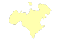
| Kaibab Squirel Habitat | |
|
|
Data format: ArcInfo Coverage File or table name: ksquirrel_hab Coordinate system: Universal Transverse Mercator Theme keywords: Bureau of Land Management, BLM, National Park Service, NPS, kaibab squirrel habitat, ponderosa pine |
|
Abstract:
The dataset identifies the distribution of kaibab squirrel on the Arizona Strip. |
|
Metadata elements shown with blue text are defined in the Federal Geographic Data Committee's (FGDC) Content Standard for Digital Geospatial Metadata (CSDGM). Elements shown with green text are defined in the ESRI Profile of the CSDGM. Elements shown with a green asterisk (*) will be automatically updated by ArcCatalog. ArcCatalog adds hints indicating which FGDC elements are mandatory; these are shown with gray text.
The dataset identifies the distribution of kaibab squirrel on the Arizona Strip.
For regional analysis and display at 1:24,000. This dataset was prepared/acquired for use in the ASDO resource management planning process.
Dataset locally known as ksquirrel_hab. This dataset and other datasets in the Arizona Strip District Office Geographic Information Database (ASDOGID) represent data for the BLM Arizona Strip District Office, and may include the Arizona Strip Field Office, Vermilion Cliffs National Monument (VCNM) and/or the Grand Canyon-Parashant National Monument (GCPNM or PARA). The Grand Canyon-Parashant National Monument is managed jointly by the BLM and the National Park Service (NPS).
ground condition
This data should not be used at a scale larger than 1:24,000.  The data and corresponding attributes are only as accurate as the source maps from which they were obtained, and may vary depending on the data and method of acquisition.

This data is suitable for regional planning, management decision support at intermediate scales (i.e. 1:24,000 or smaller), and cartographic purposes.  The data is not suitable for analysis at scales larger than 1:24,000.

If the Receiving Agency (RA) has modified the data in any way, they are obligated to describe the types of modifications they have performed on hardcopy maps utilizing the data.  RA specifically agrees not to misrepresent ASDOGID datasets or to imply that any changes made were approved by BLM ASDO or NPS.

No warranty is made by the BLM/NPS for use of the data for purposes not intended by BLM/NPS.  This information may be updated without notification.
345 East Riverside Dr.
Please use email to contact.
Feature attributes were taken from source material. Code assignments are believed to be representative of the source document.
Data was reviewed for correct topological structure. Duplicate lines have been removed.
This dataset covers the entire BLM Arizona Strip District. It is constantly being reviewed and added to as additional information becomes available.
Overall horizontal accuracy for this data is not greater than national mapping accuracy standards (NMAS) for USGS source maps. Snapping and coordinate shift tolerances were maintained at 0.01 meters or less through editing. Horizontal positional accuracy for the digital data set was tested by visual comparison of the source data with hard copy verification plots.
Kaibab squirrel habitat polygons were identified from existing vegetation data based on known habitat requirements and knowledge of prior transplanting operations.
345 East Riverside Drive
Polygons were extracted from existing ponderosa pine vegetation data according to resource managers specifications. Data file is created and stored in a master file in the computer system.
345 East Riverside Drive
Internal feature number.
ESRI
Feature geometry.
ESRI
Internal node number for the beginning of an arc (from-node).
ESRI
Internal node number for the end of an arc (to-node).
ESRI
Internal node number for the left polygon.
ESRI
Internal node number for the right polygon.
ESRI
Length of feature in internal units.
ESRI
Internal feature number.
ESRI
User-defined feature number.
ESRI
Internal feature number.
ESRI
Feature geometry.
ESRI
Area of feature in internal units squared.
ESRI
Perimeter of feature in internal units.
ESRI
Internal feature number.
ESRI
User-defined feature number.
ESRI
Defines the ecological division by vegetation type.
The exact acreage of each polygon in the dataset.
Attribute items are in typical ArcInfo point, line and polygon format.
345 East Riverside Dr.
Please contact by email.
BLM-ASDO and NPS provide this data "as is" without liability. No warranty is made by the Bureau of Land Management or National Park Service as to the accuracy, reliability, or completeness of these data for individual use or aggregate use with other data.
ESRI ArcInfo Coverage
Contact Distributor
Contact Distributor
345 East Riverside Dr.
Please contact by email.