Data format: Shapefile
File or table name: vrm_alt_e_deis
Coordinate system: Universal Transverse Mercator
Theme keywords: Bureau of Land Management, BLM, VRM, Visual Resources
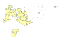
| Visual Resource Management (Alternative E) | |
|
|
Data format: Shapefile File or table name: vrm_alt_e_deis Coordinate system: Universal Transverse Mercator Theme keywords: Bureau of Land Management, BLM, VRM, Visual Resources |
|
Abstract:
Visual Resource Management (VRM)- The planning, design, and implementing of management objectives to provide acceptable levels of visual impacts for all BLM resource management activities. |
|
Metadata elements shown with blue text are defined in the Federal Geographic Data Committee's (FGDC) Content Standard for Digital Geospatial Metadata (CSDGM). Elements shown with green text are defined in the ESRI Profile of the CSDGM. Elements shown with a green asterisk (*) will be automatically updated by ArcCatalog. ArcCatalog adds hints indicating which FGDC elements are mandatory; these are shown with gray text.
Visual Resource Management (VRM)- The planning, design, and implementing of management objectives to provide acceptable levels of visual impacts for all BLM resource management activities.
For regional analysis and display at 1:24,000.
This dataset and other datasets in the BLM Phoenix District Office Geographic Information Database represent data for the BLM Phoenix District Office, and may include the Hassayampa Field Office and Lower Sonoran Field Office.


VISUAL RESOURCE MANAGEMENT (VRM) CLASSES - Categories assigned to public lands based on scenic quality, sensitivity level, and distance zones. There are four classes. Each class has an objective which prescribes the amount of change allowed in the characteristic landscape.

Class I: (Preservation) provides for natural, ecological changes only. This class includes wilderness areas, some natural areas, some wild and scenic rivers, and other similar sites where landscape modification should be restricted.

Class II: (Retention of the landscape character) includes areas where changes in any of the basic elements (form, line, color, or texture) caused by management activities should not be evident in the characteristic landscape.

Class III: (Partial retention of the landscape character) includes areas where changes in the basic elements caused by management activities may be evident in the characteristic landscape. But the changes should remain subordinate to the existing landscape character.

Class IV: (Modification of the landscape character) includes areas where changes may subordinate the original composition and character. But the changes should reflect what could be a natural occurrence in the characteristic landscape.
This data should not be used at a scale larger than 1:24,000.  The data and corresponding attributes are only as accurate as the source maps from which they were obtained, and may vary depending on the data and method of acquisition.


This data is suitable for regional planning, management decision support at intermediate scales (i.e. 1:24,000 or smaller), and cartographic purposes.  The data is not suitable for analysis at scales larger than 1:24,000.


If the Receiving Agency (RA) has modified the data in any way, they are obligated to describe the types of modifications they have performed on hardcopy maps utilizing the data.  RA specifically agrees not to misrepresent datasets or to imply that any changes made were approved by BLM.


No warranty is made by the BLM for use of the data for purposes not intended by BLM.  This information may be updated without notification.
21605 N. 7th Avenue
Feature attributes were taken from source material. Code assignments are believed to be representative of the source document.
Dataset copied.
Metadata imported.
Dataset copied.
Internal feature number.
ESRI
Feature geometry.
ESRI
21605 N. 7th Avenue
BLM Phoenix District Office provide this data "as is" without liability. No warranty is made by the Bureau of Land Management. as to the accuracy, reliability, or completeness of these data for individual use or aggregate use with other data.
Contact Distributor
21605 N. 7th Avenue