Data format: Shapefile
File or table name: wha_alt_c_deis
Coordinate system: Universal Transverse Mercator
Theme keywords: Bureau of Land Management, BLM, Phoenix District, Wildlife
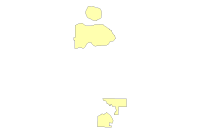
| Wildlife Habitat Area (Alternative C) | |
|
|
Data format: Shapefile File or table name: wha_alt_c_deis Coordinate system: Universal Transverse Mercator Theme keywords: Bureau of Land Management, BLM, Phoenix District, Wildlife |
|
Abstract:
Areas allocated for management focus on priority wildlife species or habitats. Examples include areas managed for bighorn sheep, pronghorn antelope, desert tortoise, riparian, etc. |
|
Metadata elements shown with blue text are defined in the Federal Geographic Data Committee's (FGDC) Content Standard for Digital Geospatial Metadata (CSDGM). Elements shown with green text are defined in the ESRI Profile of the CSDGM. Elements shown with a green asterisk (*) will be automatically updated by ArcCatalog. ArcCatalog adds hints indicating which FGDC elements are mandatory; these are shown with gray text.
Areas allocated for management focus on priority wildlife species or habitats. Examples include areas managed for bighorn sheep, pronghorn antelope, desert tortoise, riparian, etc.
For regional analysis and display at 1:24,000. This dataset was prepared/acquired for use in the PDO resource management planning process.
This dataset and other datasets in the BLM Phoenix District Office Geographic Information Database represent data for the BLM Phoenix District Office, and may include the Hassayampa Field Office and Lower Sonoran Field Office.
This data should not be used at a scale larger than 1:24,000.  The data and corresponding attributes are only as accurate as the source maps from which they were obtained, and may vary depending on the data and method of acquisition.


This data is suitable for regional planning, management decision support at intermediate scales (i.e. 1:24,000 or smaller), and cartographic purposes.  The data is not suitable for analysis at scales larger than 1:24,000.


If the Receiving Agency (RA) has modified the data in any way, they are obligated to describe the types of modifications they have performed on hardcopy maps utilizing the data.  RA specifically agrees not to misrepresent PDOGID datasets or to imply that any changes made were approved by BLM PDO.


No warranty is made by the BLM for use of the data for purposes not intended by BLM.  This information may be updated without notification.
21605 N. 7th Avenue
Feature attributes were taken from source material. Code assignments are believed to be representative of the source document.
Data was reviewed for correct topological structure. Duplicate lines have been removed.
This dataset covers the entire BLM Phoenix District. It is constantly being reviewed and added to as additional information becomes available.
The data has been vertically integrated to the Arizona BLM Geographic Coordinate Database (GCDB) and to 1:24,000 scale DLG base data, including transportation, hydrology, and powerlines where appropriate. Overall horizontal accuracy for this data is not greater than national mapping accuracy standards (NMAS) for USGS source maps. Snapping and coordinate shift tolerances were maintained at 0.01 meters or less through editing. Horizontal positional accuracy for the digital data set was tested by visual comparison of the source data with hard copy verification plots.
Metadata imported.
Dataset copied.
Dataset moved.
Internal feature number.
ESRI
Feature geometry.
ESRI
345 East Riverside Dr.
BLM-PDO provide this data "as is" without liability. No warranty is made by the Bureau of Land Management as to the accuracy, reliability, or completeness of these data for individual use or aggregate use with other data.
Contact Distributor
21605 N. 7th Ave