Data format: Shapefile
File or table name: leasable_mineral_status_alt_c
Coordinate system: Universal Transverse Mercator
Theme keywords: Bureau of Land Management, BLM, Minerals, Leasables
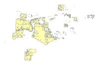
| Leasable Mineral Status - Alt C | |
|
|
Data format: Shapefile File or table name: leasable_mineral_status_alt_c Coordinate system: Universal Transverse Mercator Theme keywords: Bureau of Land Management, BLM, Minerals, Leasables |
|
Abstract:
Summary of current closures to leasable minerals, proposed closures by corresponding alternative, levels of mitigation including no surface occupancy and implicit mitigation for tortoise habitat and VRM Class II, and areas available in the BLM Mineral Estate. |
|
Metadata elements shown with blue text are defined in the Federal Geographic Data Committee's (FGDC) Content Standard for Digital Geospatial Metadata (CSDGM). Elements shown with green text are defined in the ESRI Profile of the CSDGM. Elements shown with a green asterisk (*) will be automatically updated by ArcCatalog. ArcCatalog adds hints indicating which FGDC elements are mandatory; these are shown with gray text.
Summary of current closures to leasable minerals, proposed closures by corresponding alternative, levels of mitigation including no surface occupancy and implicit mitigation for tortoise habitat and VRM Class II, and areas available in the BLM Mineral Estate.
For regional analysis and display at 1:24,000.
Dataset locally known as leasable_mineral_status_alt_c.  This dataset and other datasets in the BLM Phoenix District Office Geographic Information Database represent data for the BLM Phoenix District Office, and may include the Hassayampa Field Office and Lower Sonoran Field Office.


Leasable minerals are minerals whose extraction from federally managed land requires a lease and the payment of royalties.  Leasable minerals include coal, oil and gas, oil shale and tar sand, potash, phosphate, sodium and geothermal steam.
This data should not be used at a scale larger than 1:24,000.  The data and corresponding attributes are only as accurate as the source maps from which they were obtained, and may vary depending on the data and method of acquisition.


This data is suitable for regional planning, management decision support at intermediate scales (i.e. 1:24,000 or smaller), and cartographic purposes.  The data is not suitable for analysis at scales larger than 1:24,000.


If the Receiving Agency (RA) has modified the data in any way, they are obligated to describe the types of modifications they have performed on hardcopy maps utilizing the data.  RA specifically agrees not to misrepresent datasets or to imply that any changes made were approved by BLM.


No warranty is made by the BLM for use of the data for purposes not intended by BLM.  This information may be updated without notification.
21605 N. 7th Avenue
Feature attributes were taken from source material. Code assignments are believed to be representative of the source document.
Dataset copied.
Metadata imported.
Metadata imported.
Internal feature number.
ESRI
Feature geometry.
ESRI
21605 N. 7th Avenue
BLM Phoenix District Office provide this data "as is" without liability. No warranty is made by the Bureau of Land Management. as to the accuracy, reliability, or completeness of these data for individual use or aggregate use with other data.
Contact Distributor
21605 N. 7th Avenue