Data format: Shapefile
File or table name: re_sensitivity_alt_b_deis
Coordinate system: Universal Transverse Mercator
Theme keywords: Bureau of Land Management, BLM, Renewable Energy
| Renewable Energy Sensitivity - Alternative B | |
|
|
Data format: Shapefile File or table name: re_sensitivity_alt_b_deis Coordinate system: Universal Transverse Mercator Theme keywords: Bureau of Land Management, BLM, Renewable Energy |
|
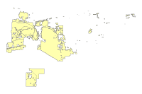
Abstract:
Layer depicts analysis conducted for varying degrees of sensitivity to utility-scale renewable energy development. BLM lands within the SDNM and LSFO have been characterized as: exclude, high sensitivity, moderate sensitivity, and low known sensitivity. |
|
Metadata elements shown with blue text are defined in the Federal Geographic Data Committee's (FGDC) Content Standard for Digital Geospatial Metadata (CSDGM). Elements shown with green text are defined in the ESRI Profile of the CSDGM. Elements shown with a green asterisk (*) will be automatically updated by ArcCatalog. ArcCatalog adds hints indicating which FGDC elements are mandatory; these are shown with gray text.
Layer depicts analysis conducted for varying degrees of sensitivity to utility-scale renewable energy development. BLM lands within the SDNM and LSFO have been characterized as: exclude, high sensitivity, moderate sensitivity, and low known sensitivity.
For regional analysis and display at 1:24,000.
Dataset locally known as 'renewable_energy_sensitivity_altc'.  This dataset and other datasets in the BLM Phoenix District Office Geographic Information Database represent data for the BLM Phoenix District Office, and may include the Hassayampa Field Office and Lower Sonoran Field Office.


Renewable Energy Development for BLM public lands was characterized into one of four sensitivity categories:


1. Exclude: Utility-scale renewable energy development would be excluded.


2. High sensitivity: Utility-scale renewable energy development would be entertained, but it is highly likely applications would be rejected due to non-conformance with Land Use Plans, or unacceptable resource conflicts.


3. Moderate sensitivity: Utility-scale renewable energy development would be entertained, but it is likely some plan or resource conflict will complicate development and may lead to the application being rejected.


4. Low known sensitivity: The known plan or resource conflicts are low, so application processing will likely procedd more smoothly. However, upon site-specific inspections, resource conflicts may still be found that represent significant conflicts.
This data should not be used at a scale larger than 1:24,000.  The data and corresponding attributes are only as accurate as the source maps from which they were obtained, and may vary depending on the data and method of acquisition.


This data is suitable for regional planning, management decision support at intermediate scales (i.e. 1:24,000 or smaller), and cartographic purposes.  The data is not suitable for analysis at scales larger than 1:24,000.


If the Receiving Agency (RA) has modified the data in any way, they are obligated to describe the types of modifications they have performed on hardcopy maps utilizing the data.  RA specifically agrees not to misrepresent datasets or to imply that any changes made were approved by BLM.


No warranty is made by the BLM for use of the data for purposes not intended by BLM.  This information may be updated without notification.
21605 N. 7th Avenue
Feature attributes were taken from source material. Code assignments are believed to be representative of the source document.
Dataset copied.
Metadata imported.
Metadata imported.
Internal feature number.
ESRI
Feature geometry.
ESRI
21605 N. 7th Avenue
BLM Phoenix District Office provide this data "as is" without liability. No warranty is made by the Bureau of Land Management. as to the accuracy, reliability, or completeness of these data for individual use or aggregate use with other data.
Contact Distributor
21605 N. 7th Avenue