SDNM Route Designation

Data format: Shapefile

File or table name: sdnm_route_designation

Coordinate system: Universal Transverse Mercator

Theme keywords: Bureau of Land Management, BLM, Phoenix District, Route Designation, Routes
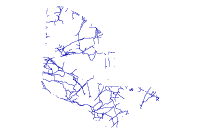
Abstract: Sonoran Desert National Monument route designations and asset type descriptions for all alternatives. See attribute tab for more thorough descriptions.

FGDC and ESRI Metadata:

Metadata elements shown with blue text are defined in the Federal Geographic Data Committee's (FGDC) Content Standard for Digital Geospatial Metadata (CSDGM). Elements shown with green text are defined in the ESRI Profile of the CSDGM. Elements shown with a green asterisk (*) will be automatically updated by ArcCatalog. ArcCatalog adds hints indicating which FGDC elements are mandatory; these are shown with gray text.

Identification Information:


Citation:
Citation information:
Originators: Bureau of Land Management, Phoenix District Office (BLM-PDO)


Title:
SDNM Route Designation
*File or table name: sdnm_route_designation


Publication date: REQUIRED: The date when the data set is published or otherwise made available for release.
*Geospatial data presentation form: vector digital data


Publication information:
Publication place: Phoenix, AZ
Publisher: BLM-PDO

Description:
Abstract:
Sonoran Desert National Monument route designations and asset type descriptions for all alternatives.  See attribute tab for more thorough descriptions.

Purpose:
For regional analysis and display at 1:24,000.  This dataset was prepared/acquired for use in the PDO resource management planning process.

Supplemental information:
Routes will recieve a designation among the following for each alternative-

Open to all uses, Administrative use only, Seasonally Closed (Either from Feb 1 to Sep 15, or Apr 15 to Sep 15), Limited to Vehicles 50" or Less, Open to Non-Motorized Use, or  Closed to All Uses.  


Routes were also given an asset type among the following-

Road- Either considered a primary or secondary road.  

Primitive Road- Either considered a secondary or tertiary road.

Trails- Unpassable by vehicle, generally considered for non-motorized, non-mechanized use only.


Primary Road - A regularly maintained route, paved or unpaved, wide enough for at least two vehicles to pass. Provides access between two major points. Serves a large area with many routes of lesser quality branching from it.

Secondary Road - Paved or unpaved, a regularly maintained one- to two-lane route with routes of lesser quality branching from it. Connects primary roads and major points.

Tertiary Road - Generally a two-track route that may or may not be usable by a two-wheel drive vehicle. Does not receive formal maintenance.

Single-Track Route - A route up to 1/2 meter wide upon which all-terrain vehicles or trucks are not allowed.

Way - A road-like feature used by vehicles having four or more wheels but not declared a road by the owner. A way receives no maintenance to guarantee regular and continuous use.

Spur - A route that exists for a specific purpose, such as access to a specific use or feature. Uses can be recreational or commercial. Features include campsites, mines, or range developments. A spur route is connected to another road or route type.

Reclaiming or Reclaimed (route) - A route that has had very little or no use, so that there is woody vegetation growing in the route that would be damaged by the passage of a vehicle. Erosion or vegetation may block the route and could damage a vehicle or cause it to get stuck.

*Language of dataset: en


Time period of content:
Time period information:
Single date/time:
Calendar date: REQUIRED: The year (and optionally month, or month and day) for which the data set corresponds to the ground.

Currentness reference:
REQUIRED: The basis on which the time period of content information is determined.

Status:
Progress: In work
Maintenance and update frequency: As needed

Spatial domain:
Bounding coordinates:
*West bounding coordinate: -112.662630
*East bounding coordinate: -111.979340
*North bounding coordinate: 33.223986
*South bounding coordinate: 32.632369

Local bounding coordinates:
*Left bounding coordinate: 345056.238883
*Right bounding coordinate: 408141.952012
*Top bounding coordinate: 3676551.450073
*Bottom bounding coordinate: 3611737.083412

Keywords:
Theme:
Theme keywords: Bureau of Land Management, BLM, Phoenix District, Route Designation, Routes
Theme keyword thesaurus: None

Theme:
Theme keyword thesaurus: ISO 19115

Theme:
Theme keyword thesaurus: BLM-Theme

Place:
Place keywords: Arizona
Place keyword thesaurus: BLM-State

Place:
Place keywords: Phoenix District, Sonoran Desert National Monument
Place keyword thesaurus: None

Access constraints: Discretionary, contains no sensitive information - generally considered releasable.
Use constraints:
This data should not be used at a scale larger than 1:24,000.  The data and corresponding attributes are only as accurate as the source maps from which they were obtained, and may vary depending on the data and method of acquisition.


This data is suitable for regional planning, management decision support at intermediate scales (i.e. 1:24,000 or smaller), and cartographic purposes.  The data is not suitable for analysis at scales larger than 1:24,000.


If the Receiving Agency (RA) has modified the data in any way, they are obligated to describe the types of modifications they have performed on hardcopy maps utilizing the data.  RA specifically agrees not to misrepresent PDOGID datasets or to imply that any changes made were approved by BLM PDO.


No warranty is made by the BLM for use of the data for purposes not intended by BLM.  This information may be updated without notification.

Point of contact:
Contact information:
Contact organization primary:
Contact organization: Bureau of Land Management, Phoenix District Office (BLM-PDO)
Contact position: GIS Specialist


Contact address:
Address type: mailing and physical address
Address:
345 East Riverside Dr.
City: St. George
State or province: Utah
Postal code: 84790
Country: USA

Contact voice telephone: (623)580-5500


Hours of service: Monday through Friday 8am-5pm MDT


*Native dataset format: Shapefile
*Native data set environment:
Microsoft Windows XP Version 5.1 (Build 2600) Service Pack 3; ESRI ArcCatalog 9.3.1.1850


Back to Top
Data Quality Information:


Attribute accuracy:
Attribute accuracy report:
Feature attributes were taken from source material.  Code assignments are believed to be representative of the source document.

Logical consistency report:
Data was reviewed for correct topological structure.  Duplicate lines have been removed.

Completeness report:
This dataset covers the entire BLM Phoenix District.  It is constantly being reviewed and added to as additional information becomes available.

Positional accuracy:
Horizontal positional accuracy:
Horizontal positional accuracy report:
The data has been vertically integrated to the Arizona BLM Geographic Coordinate Database (GCDB) and to 1:24,000 scale DLG base data, including transportation, hydrology, and powerlines where appropriate.  Overall horizontal accuracy for this data is not greater than national mapping accuracy standards (NMAS) for USGS source maps.  Snapping and coordinate shift tolerances were maintained at 0.01 meters or less through editing.  Horizontal positional accuracy for the digital data set was tested by visual comparison of the source data with hard copy verification plots.

Lineage:
Process step:
Process description:
Metadata imported.

Process date: 20100503
Process time: 14103500


Source used citation abbreviation:
C:\DOCUME~1\cgarbo\LOCALS~1\Temp\xml4F7C.tmp


Process step:
Process description:
Dataset copied.

Process date: 20100727
Process time: 10262600


Source used citation abbreviation:
R:\projects\LS_SDNM_DRMP_DEIS\GIS_DATA\Travel_Management\sdnm_routes_joined


Cloud cover: Unknown
Back to Top
Spatial Data Organization Information:


*Direct spatial reference method: Vector


Point and vector object information:
SDTS terms description:
*Name: sdnm_route_designation
*SDTS point and vector object type: String
*Point and vector object count: 1329

ESRI terms description:
*Name: sdnm_route_designation
*ESRI feature type: Simple
*ESRI feature geometry: Polyline
*ESRI topology: FALSE
*ESRI feature count: 1329
*Spatial index: FALSE
*Linear referencing: FALSE


Back to Top
Spatial Reference Information:


Horizontal coordinate system definition:
Coordinate system name:
*Projected coordinate system name: NAD_1983_UTM_Zone_12N
*Geographic coordinate system name: GCS_North_American_1983

Planar:
Grid coordinate system:
*Grid coordinate system name: Universal Transverse Mercator
Universal Transverse Mercator:
*UTM zone number: 12
Transverse mercator:
*Scale factor at central meridian: 0.999600
*Longitude of central meridian: -111.000000
*Latitude of projection origin: 0.000000
*False easting: 500000.000000
*False northing: 0.000000

Planar coordinate information:
*Planar coordinate encoding method: coordinate pair
Coordinate representation:
*Abscissa resolution: 0.000000
*Ordinate resolution: 0.000000
*Planar distance units: meters

Geodetic model:
*Horizontal datum name: North American Datum of 1983
*Ellipsoid name: Geodetic Reference System 80
*Semi-major axis: 6378137.000000
*Denominator of flattening ratio: 298.257222

Back to Top
Entity and Attribute Information:


Detailed description:
*Name: sdnm_route_designation


Entity type:
*Entity type label: sdnm_route_designation
*Entity type type: Feature Class
*Entity type count: 1329
Entity type definition source:
Arizona Route Inventory Data Dictionary; Arizona BLM, Arizona State Lands, and Region 3 Forest Service (May 2010)

Attribute:
*Attribute label: FID
*Attribute alias: FID
*Attribute definition:
Internal feature number.
*Attribute definition source:
ESRI

*Attribute type: OID
*Attribute width: 4
*Attribute precision: 0
*Attribute scale: 0


Attribute domain values:
*Unrepresentable domain:
Sequential unique whole numbers that are automatically generated.


Attribute:
*Attribute label: Shape
*Attribute alias: Shape
*Attribute definition:
Feature geometry.
*Attribute definition source:
ESRI

*Attribute type: Geometry
*Attribute width: 0
*Attribute precision: 0
*Attribute scale: 0


Attribute domain values:
*Unrepresentable domain:
Coordinates defining the features.


Attribute:
*Attribute label: ROUTE_TYPE
*Attribute alias: ROUTE_TYPE
Attribute definition:
-Reclaiming [R]  Has not been used enough so that there is intact woody vegetation growing in it that would be damaged by the passage of a vehicle.  Erosion and vegetation may block way, cause vehicle to get stuck and/or cause damage to vehicle. Crew should use discretion in traversing such a route.  Single Track [ST]  Pedestrian, bicycle, motorcycle; trucks and ATVs are prohibited.     Can be up to 50 inches (approximately 1.25 meters) wide. Tertiary_Road_Unpav [TRU]  *default* Generally a two-track that may or may not be   usable by a two-wheel drive vehicle.  Generally, formal maintenance is not performed on this type of route.  Secondary_Road_Unpav [SRU]  Generally, a regularly maintained one-lane road, with   other roads of lesser quality branching from it.  Connects primary roads, and major  points.  Secondary_Road_Paved [SRP]  A paved road that is not a highway, with other roads of lesser quality branching from it.  Often not striped.  Connects primary roads and major points.  Primary_Road_Unpaved [PRU]  A regularly maintained road wide enough for at least   two vehicles.  Provides access between major points.  Serves a large area, with many   roads branching from it.  Primary_Road_Paved [PRP]  Major/Minor highway.  Provides access between major    points.  Serves a large area, with many roads branching from it.

*Attribute type: String
*Attribute width: 20


Attribute:
*Attribute label: WIDTH
*Attribute alias: WIDTH
Attribute definition:
Range from 0.5 to 30, in meters; *default* is 2.5, the width of most Tertiary Road Unpaved

*Attribute type: Number
*Attribute width: 19
*Attribute number of decimals: 11


Attribute:
*Attribute label: WASH
*Attribute alias: WASH
Attribute definition:
Determines if route in wash

*Attribute type: String
*Attribute width: 20


Attribute:
*Attribute label: SURFACE_PR
*Attribute alias: SURFACE_PR
Attribute definition:
Kind of surface: Asphalt [A] Paved; Chip Seal [CS] Gravel material mixed with oil based substance;  Gravel (Imported) [GI]  Material was brought in from offsite; road bed can be raised; Gravel (Natural) [GN] *default*  Surface is covered with natural gravel.  Common in areas of decomposed granite and desert pavement; Soil [S] The term here is used in a generic rather than technical sense.  It is the native ground composed of fine particles. Includes deep dust situations;  Sand [Sa]  Usually in routes in drainage bottoms; Cobbles [C]  Large rocks generally 6" or more in diameter.  Usually in routes in drainage bottoms; Rock [R]  Generally less than 6" in diameter that is rough to drive on; usually on steeper slopes on mountains; Bedrock [B]  Exposed expanses of bedrock, usually due to erosion on an unmaintained route or in a drainage.

*Attribute type: String
*Attribute width: 20


Attribute:
*Attribute label: SURFACE_SE
*Attribute alias: SURFACE_SE
Attribute definition:
Surface-Secondary,  Kind of surface.  Same as previous, in addition to -Dash [-]  *default*   Route Material in Primary category is sufficient description.

*Attribute type: String
*Attribute width: 20


Attribute:
*Attribute label: OBS_USE1
*Attribute alias: OBS_USE1
Attribute definition:
Primary Use, What is seen; not a formal designation.  Types: Dash  [-]  Undetermined; 4WD [F]  *default* Route is eroded and/or steep preventing two-wheel drive vehicles from using the road.  Long-bed pickup trucks may run into trouble, especially crossing narrow washes; 2WD [T]  All paved roads, most Secondary_Road_Unpaved routes, and a few Tertiary_Paved_Unpaved that are smooth enough for at least higher-clearance vehicles; Motorcycle [M]  Can tell by tire tread and occasional broken accessory; ATV [A]  Can tell from unique, wide tread;  Bicycle [B] Can tell by narrow tire tread; Hiking [H]  Single-track trails signed for hiking.  Wilderness.  Footprints present.  Tread is often rougher than those used by ATVs, motorcycles and bicycles.  Some motorized trails may also be in use by hikers; Equestrian [E]  Horseback riding trails.  Dung and hoofmarks often a clue.

*Attribute type: String
*Attribute width: 20


Attribute:
*Attribute label: OBS_USE2
*Attribute alias: OBS_USE2
Attribute definition:
Secondary Use.  Types: See Use1

*Attribute type: String
*Attribute width: 20


Attribute:
*Attribute label: OBS_USE3
*Attribute alias: OBS_USE3
Attribute definition:
Tertiary Use.  Types: See Use1

*Attribute type: String
*Attribute width: 20


Attribute:
*Attribute label: USE_LEVEL
*Attribute alias: USE_LEVEL
Attribute definition:
Use Level Observed/estimated from tread condition.  Types: Heavy [H]  Direct or indirect evidence of regular usage; Light [L] *default*  Clear evidence of infrequent usage, in light of observed environmental factors;  Non-Existent [NE]  Generally for reclaiming roads, with rare exceptions for recently abandoned road; Undetermined [U]  Observer unable to determine use level, due to solid rock surface or environmental factors (e.g. recent precipitation).

*Attribute type: String
*Attribute width: 20


Attribute:
*Attribute label: ROAD_NO_
*Attribute alias: ROAD_NO_
Attribute definition:
Road Number.  Number of highway or designated route, such as those in National Forests.

*Attribute type: String
*Attribute width: 10


Attribute:
*Attribute label: ROAD_NAME
*Attribute alias: ROAD_NAME
Attribute definition:
Name, official or local or highway ro designated route

*Attribute type: String
*Attribute width: 30


Attribute:
*Attribute label: RECORDER
*Attribute alias: RECORDER
Attribute definition:
Initials of person gathering data.

*Attribute type: String
*Attribute width: 3


Attribute:
*Attribute label: COMMENT
*Attribute alias: COMMENT
Attribute definition:
Any comment that does not fit in other parts of the Menu.  Use this field for observations that pertain to past maintenance on a particular route.

*Attribute type: String
*Attribute width: 52


Attribute:
*Attribute label: MAINTENANC
*Attribute alias: MAINTENANC
Attribute definition:
Describes maintenance needed.  Generally does not apply to unpaved tertiary roads and single tracks.  Types: Dust_Abatement [DA]; Shoulder Maintenance [SM]; Stripping [ST]; Washboard [WB]; Grading [GR]; Aggregate_Replace [AG].

*Attribute type: String
*Attribute width: 20


Attribute:
*Attribute label: MAX_PDOP
*Attribute alias: MAX_PDOP


*Attribute type: Number
*Attribute width: 19
*Attribute number of decimals: 11


Attribute:
*Attribute label: CORR_TYPE
*Attribute alias: CORR_TYPE


*Attribute type: String
*Attribute width: 36


Attribute:
*Attribute label: RCVR_TYPE
*Attribute alias: RCVR_TYPE


*Attribute type: String
*Attribute width: 36


Attribute:
*Attribute label: GPS_DATE
*Attribute alias: GPS_DATE


*Attribute type: Date
*Attribute width: 8


Attribute:
*Attribute label: GPS_TIME
*Attribute alias: GPS_TIME


*Attribute type: String
*Attribute width: 10


Attribute:
*Attribute label: FEAT_NAME
*Attribute alias: FEAT_NAME


*Attribute type: String
*Attribute width: 20


Attribute:
*Attribute label: DATAFILE
*Attribute alias: DATAFILE


*Attribute type: String
*Attribute width: 20


Attribute:
*Attribute label: RTNUMBER
*Attribute alias: RTNUMBER


*Attribute type: Number
*Attribute width: 9


Attribute:
*Attribute label: OID_
*Attribute alias: OID_


*Attribute type: Number
*Attribute width: 9


Attribute:
*Attribute label: SUBSUBREGI
*Attribute alias: SUBSUBREGI
Attribute definition:
Subregion of SDNM

*Attribute type: String
*Attribute width: 27


Attribute:
*Attribute label: ARS_RTE_NO
*Attribute alias: ARS_RTE_NO
Attribute definition:
ARS Assigned Route Number used throughout designation process.

*Attribute type: String
*Attribute width: 10


Attribute:
*Attribute label: BLM_Route
*Attribute alias: BLM_Route
Attribute definition:
Not yet assigned, part of implementation process.

*Attribute type: String
*Attribute width: 20


Attribute:
*Attribute label: Miles
*Attribute alias: Miles
Attribute definition:
Length of route or route segment in miles.

*Attribute type: Float
*Attribute width: 19
*Attribute number of decimals: 11


Attribute:
*Attribute label: AgencyRo_1
*Attribute alias: AgencyRo_1
Attribute definition:
Name of route, officially or locally.

*Attribute type: String
*Attribute width: 254


Attribute:
*Attribute label: Alt_A
*Attribute alias: Alt_A
Attribute definition:
Existing route designation.  Routes are either open or closed, and there are no asset types assigned to Alt A, since this is a new type of classification implemented in the planning process.

*Attribute type: String
*Attribute width: 50


Attribute:
*Attribute label: Alt_B_Des
*Attribute alias: Alt_B_Des
Attribute definition:
See Metadata under Supplementary Information in the Description of the Shapefile.

*Attribute type: String
*Attribute width: 50


Attribute:
*Attribute label: Alt_C_Des
*Attribute alias: Alt_C_Des
Attribute definition:
See Metadata under Supplementary Information in the Description of the Shapefile.

*Attribute type: String
*Attribute width: 50


Attribute:
*Attribute label: Alt_D_Des
*Attribute alias: Alt_D_Des
Attribute definition:
See Metadata under Supplementary Information in the Description of the Shapefile.

*Attribute type: String
*Attribute width: 50


Attribute:
*Attribute label: Alt_E_Des
*Attribute alias: Alt_E_Des
Attribute definition:
See Metadata under Supplementary Information in the Description of the Shapefile.

*Attribute type: String
*Attribute width: 50


Attribute:
*Attribute label: B_Asset_Ty
*Attribute alias: B_Asset_Ty
Attribute definition:
See Metadata under Supplementary Information in the Description of the Shapefile.

*Attribute type: String
*Attribute width: 50


Attribute:
*Attribute label: C_Asset_Ty
*Attribute alias: C_Asset_Ty
Attribute definition:
See Metadata under Supplementary Information in the Description of the Shapefile.

*Attribute type: String
*Attribute width: 50


Attribute:
*Attribute label: D_Asset_Ty
*Attribute alias: D_Asset_Ty
Attribute definition:
See Metadata under Supplementary Information in the Description of the Shapefile.

*Attribute type: String
*Attribute width: 50


Attribute:
*Attribute label: E_Asset_Ty
*Attribute alias: E_Asset_Ty
Attribute definition:
See Metadata under Supplementary Information in the Description of the Shapefile.

*Attribute type: String
*Attribute width: 50


Overview description:
Back to Top
Distribution Information:


Distributor:
Contact information:
Contact organization primary:
Contact organization: Bureau of Land Management, Arizona Strip District Office (BLM-ASDO)
Contact position: GIS Specialist


Contact address:
Address type: mailing and physical address
Address:
345 East Riverside Dr.
City: St. George
State or province: Utah
Postal code: 84790
Country: USA

Contact voice telephone: (435)688-3200 or (435) 688-3246


Hours of service: Monday through Friday 8am-5pm MDT


Resource description: Downloadable Data


Distribution liability:
BLM-PDO provide this data "as is" without liability.  No warranty is made by the Bureau of Land Management as to the accuracy, reliability, or completeness of these data for individual use or aggregate use with other data.

Standard order process:
Digital form:
Digital transfer information:
*Transfer size: 0.777
*Dataset size: 0.777

Custom order process:
Contact Distributor
Technical prerequisites:
ESRI software or software compatible with ESRI file formats


Back to Top
Metadata Reference Information:


*Metadata date: 20110803


*Language of metadata: en


Metadata contact:
Contact information:
Contact organization primary:
Contact person: REQUIRED: The person responsible for the metadata information.
Contact organization: Bureau of Land Management, Phoenix District Office
Contact position: GIS Specialist


Contact address:
Address type: mailing and physical address
Address:
21605 N. 7th Ave
City: Phoenix
State or province: Arizona
Postal code: 85027
Country: USA

Contact voice telephone: (623) 580-5500


Hours of service: Monday through Friday 8am-5pm MDT


*Metadata standard name: FGDC Content Standards for Digital Geospatial Metadata
*Metadata standard version: FGDC-STD-001-1998
*Metadata time convention: local time


Metadata access constraints: None
Metadata use constraints:
None


Metadata security information:
Metadata security classification system: None

Metadata extensions:
*Online linkage: http://www.esri.com/metadata/esriprof80.html
*Profile name: ESRI Metadata Profile

Back to Top
Binary Enclosures:


Thumbnail:
Enclosure type: Picture


Back to Top