VR Inventory Classes

Data format: Shapefile

File or table name: lsfo_visual_resource_invento

Coordinate system: Universal Transverse Mercator
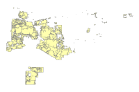
Abstract: Polygon features depicting the Visual Resource Inventory classification determined during the inventory process. These classifications are informational and do not constitute a management class.

FGDC and ESRI Metadata:

Metadata elements shown with blue text are defined in the Federal Geographic Data Committee's (FGDC) Content Standard for Digital Geospatial Metadata (CSDGM). Elements shown with green text are defined in the ESRI Profile of the CSDGM. Elements shown with a green asterisk (*) will be automatically updated by ArcCatalog. ArcCatalog adds hints indicating which FGDC elements are mandatory; these are shown with gray text.

Identification Information:


Citation:
Citation information:
Originators: REQUIRED: The name of an organization or individual that developed the data set.


Title:
VR Inventory Classes
*File or table name: lsfo_visual_resource_invento


Publication date: REQUIRED: The date when the data set is published or otherwise made available for release.
*Geospatial data presentation form: vector digital data


Description:
Abstract:
Polygon features depicting the Visual Resource Inventory classification determined during the inventory process.  These classifications are informational and do not constitute a management class.

Purpose:
This feature class is for documenting the results from the visual resource inventory process.  Inventory classes are informational and do not constitute visual resource management classes.

*Language of dataset: en


Time period of content:
Time period information:
Single date/time:
Calendar date: REQUIRED: The year (and optionally month, or month and day) for which the data set corresponds to the ground.

Currentness reference:
REQUIRED: The basis on which the time period of content information is determined.

Status:
Progress: REQUIRED: The state of the data set.
Maintenance and update frequency: REQUIRED: The frequency with which changes and additions are made to the data set after the initial data set is completed.

Spatial domain:
Bounding coordinates:
*West bounding coordinate: -113.354867
*East bounding coordinate: -110.734118
*North bounding coordinate: 33.557027
*South bounding coordinate: 32.191166

Local bounding coordinates:
*Left bounding coordinate: 281330.236827
*Right bounding coordinate: 524680.499900
*Top bounding coordinate: 3713041.750000
*Bottom bounding coordinate: 3563984.250000

Keywords:
Theme:
Theme keywords: REQUIRED: Common-use word or phrase used to describe the subject of the data set.
Theme keyword thesaurus: REQUIRED: Reference to a formally registered thesaurus or a similar authoritative source of theme keywords.

Access constraints: REQUIRED: Restrictions and legal prerequisites for accessing the data set.
Use constraints:
Inventory data shall be labeled "INFORMATIONAL ONLY" when shared or distributed

*Native dataset format: Shapefile
*Native data set environment:
Microsoft Windows XP Version 5.1 (Build 2600) Service Pack 3; ESRI ArcCatalog 9.3.1.1850


Back to Top
Data Quality Information:


Lineage:
Process step:
Process description:
Dataset copied.

Process date: 20100816
Process time: 10032000


Source used citation abbreviation:
\\blm\dfs\AZ\PN\LOC\GIS\USERDATA\slfisher\Data\VRM\lower_sonoran_vri_db.gdb


Process step:
Process description:
Dataset copied.

Process date: 20100816
Process time: 10103600


Source used citation abbreviation:
\\blm\dfs\AZ\PN\LOC\GIS\USERDATA\slfisher\Data\VRM\lower_sonoran_vri_db.gdb


Back to Top
Spatial Data Organization Information:


*Direct spatial reference method: Vector


Point and vector object information:
SDTS terms description:
*Name: lsfo_visual_resource_invento
*SDTS point and vector object type: G-polygon
*Point and vector object count: 120

ESRI terms description:
*Name: lsfo_visual_resource_invento
*ESRI feature type: Simple
*ESRI feature geometry: Polygon
*ESRI topology: FALSE
*ESRI feature count: 120
*Spatial index: TRUE
*Linear referencing: FALSE


Back to Top
Spatial Reference Information:


Horizontal coordinate system definition:
Coordinate system name:
*Projected coordinate system name: NAD_1983_UTM_Zone_12N
*Geographic coordinate system name: GCS_North_American_1983

Planar:
Grid coordinate system:
*Grid coordinate system name: Universal Transverse Mercator
Universal Transverse Mercator:
*UTM zone number: 12
Transverse mercator:
*Scale factor at central meridian: 0.999600
*Longitude of central meridian: -111.000000
*Latitude of projection origin: 0.000000
*False easting: 500000.000000
*False northing: 0.000000

Planar coordinate information:
*Planar coordinate encoding method: coordinate pair
Coordinate representation:
*Abscissa resolution: 0.000000
*Ordinate resolution: 0.000000
*Planar distance units: meters

Geodetic model:
*Horizontal datum name: North American Datum of 1983
*Ellipsoid name: Geodetic Reference System 80
*Semi-major axis: 6378137.000000
*Denominator of flattening ratio: 298.257222

Vertical coordinate system definition:
Altitude system definition:
*Altitude resolution: 0.000100
*Altitude encoding method: Explicit elevation coordinate included with horizontal coordinates

Back to Top
Entity and Attribute Information:


Detailed description:
*Name: lsfo_visual_resource_invento


Entity type:
*Entity type label: lsfo_visual_resource_invento
*Entity type type: Feature Class
*Entity type count: 120
Entity type definition:
Visual Resource Inventory Classes Polygons
Entity type definition source:
BLM

Attribute:
*Attribute label: FID
*Attribute alias: FID
*Attribute definition:
Internal feature number.
*Attribute definition source:
ESRI

*Attribute type: OID
*Attribute width: 4
*Attribute precision: 0
*Attribute scale: 0


Attribute domain values:
*Unrepresentable domain:
Sequential unique whole numbers that are automatically generated.


Attribute:
*Attribute label: SHAPE
*Attribute alias: Shape
*Attribute definition:
Feature geometry.
*Attribute definition source:
ESRI

*Attribute type: Geometry
*Attribute width: 0
*Attribute precision: 0
*Attribute scale: 0


Attribute domain values:
*Unrepresentable domain:
Coordinates defining the features.


Attribute:
*Attribute label: VRI_CLASS_
*Attribute alias: VRI_CLASS_


*Attribute type: String
*Attribute width: 3


Back to Top
Distribution Information:


Resource description: Downloadable Data


Standard order process:
Digital form:
Digital transfer information:
*Transfer size: 2.016
*Dataset size: 2.016

Back to Top
Metadata Reference Information:


*Metadata date: 20110803


*Language of metadata: en


Metadata contact:
Contact information:
Contact organization primary:
Contact person: REQUIRED: The person responsible for the metadata information.
Contact organization: REQUIRED: The organization responsible for the metadata information.

Contact address:
Address type: REQUIRED: The mailing and/or physical address for the organization or individual.
City: REQUIRED: The city of the address.
State or province: REQUIRED: The state or province of the address.
Postal code: REQUIRED: The ZIP or other postal code of the address.

Contact voice telephone: REQUIRED: The telephone number by which individuals can speak to the organization or individual.


*Metadata standard name: FGDC Content Standards for Digital Geospatial Metadata
*Metadata standard version: FGDC-STD-001-1998
*Metadata time convention: local time


Metadata extensions:
*Online linkage: http://www.esri.com/metadata/esriprof80.html
*Profile name: ESRI Metadata Profile

Back to Top
Geoprocessing History:


Process:
*Date: 20110112
*Time: 140901
*Tool location: C:\Program Files\ArcGIS\ArcToolbox\Toolboxes\Conversion Tools.tbx\FeatureClassToFeatureClass
*Command issued: FeatureClassToFeatureClass R:\projects\LS_SDNM_DRMP_DEIS\GIS_DATA\Recreation\VRM\lower_sonoran_vri_db\lower_sonoran_vri_db.gdb\vri_NAD83\vri_class_poly_1 R:\projects\LS_SDNM_DRMP_DEIS\GIS_DATA_To_Public\VisualResources\Chapter3 lsfo_visual_resource_inventory.shp # "VRI_AREA_I 'Inventory Class Area Unique ID' true false false 15 Text 0 0 ,First,#,R:\projects\LS_SDNM_DRMP_DEIS\GIS_DATA\Recreation\VRM\lower_sonoran_vri_db\lower_sonoran_vri_db.gdb\vri_NAD83\vri_class_poly_1,VRI_AREA_ID,-1,-1;ADMIN_ST 'Administrative State Code' true false false 2 Text 0 0 ,First,#,R:\projects\LS_SDNM_DRMP_DEIS\GIS_DATA\Recreation\VRM\lower_sonoran_vri_db\lower_sonoran_vri_db.gdb\vri_NAD83\vri_class_poly_1,ADMIN_ST,-1,-1;ADM_OFC_CD 'Administrative Office Code' true false false 6 Text 0 0 ,First,#,R:\projects\LS_SDNM_DRMP_DEIS\GIS_DATA\Recreation\VRM\lower_sonoran_vri_db\lower_sonoran_vri_db.gdb\vri_NAD83\vri_class_poly_1,ADM_OFC_CD,-1,-1;ADM_UNIT_C 'Administrative Unit Code' true true false 8 Text 0 0 ,First,#,R:\projects\LS_SDNM_DRMP_DEIS\GIS_DATA\Recreation\VRM\lower_sonoran_vri_db\lower_sonoran_vri_db.gdb\vri_NAD83\vri_class_poly_1,ADM_UNIT_CD,-1,-1;VRI_AREA_N 'VRI Area Number' true false false 4 Text 0 0 ,First,#,R:\projects\LS_SDNM_DRMP_DEIS\GIS_DATA\Recreation\VRM\lower_sonoran_vri_db\lower_sonoran_vri_db.gdb\vri_NAD83\vri_class_poly_1,VRI_AREA_NR,-1,-1;ADMIN_FO_N 'Administrative Field Office Name' true false false 40 Text 0 0 ,First,#,R:\projects\LS_SDNM_DRMP_DEIS\GIS_DATA\Recreation\VRM\lower_sonoran_vri_db\lower_sonoran_vri_db.gdb\vri_NAD83\vri_class_poly_1,ADMIN_FO_NM,-1,-1;VRI_EVAL 'VRI Class Evaluators' true false false 120 Text 0 0 ,First,#,R:\projects\LS_SDNM_DRMP_DEIS\GIS_DATA\Recreation\VRM\lower_sonoran_vri_db\lower_sonoran_vri_db.gdb\vri_NAD83\vri_class_poly_1,VRI_EVAL,-1,-1;VRI_CONTAC 'VRI Current Contact' true false false 30 Text 0 0 ,First,#,R:\projects\LS_SDNM_DRMP_DEIS\GIS_DATA\Recreation\VRM\lower_sonoran_vri_db\lower_sonoran_vri_db.gdb\vri_NAD83\vri_class_poly_1,VRI_CONTACT,-1,-1;VRI_ORIG_D 'VRI Class Original Assignment Date' true false false 8 Date 0 0 ,First,#,R:\projects\LS_SDNM_DRMP_DEIS\GIS_DATA\Recreation\VRM\lower_sonoran_vri_db\lower_sonoran_vri_db.gdb\vri_NAD83\vri_class_poly_1,VRI_ORIG_DT,-1,-1;VRI_MOD_DT 'VRI Class Last Modification Date' true true false 8 Date 0 0 ,First,#,R:\projects\LS_SDNM_DRMP_DEIS\GIS_DATA\Recreation\VRM\lower_sonoran_vri_db\lower_sonoran_vri_db.gdb\vri_NAD83\vri_class_poly_1,VRI_MOD_DT,-1,-1;VRI_CLASS_ 'VRI Class Code' true false false 3 Text 0 0 ,First,#,R:\projects\LS_SDNM_DRMP_DEIS\GIS_DATA\Recreation\VRM\lower_sonoran_vri_db\lower_sonoran_vri_db.gdb\vri_NAD83\vri_class_poly_1,VRI_CLASS_CODE,-1,-1;BLM_ACRE 'BLM Acreage' true false false 8 Double 0 0 ,First,#,R:\projects\LS_SDNM_DRMP_DEIS\GIS_DATA\Recreation\VRM\lower_sonoran_vri_db\lower_sonoran_vri_db.gdb\vri_NAD83\vri_class_poly_1,BLM_ACRE,-1,-1;SQ_CODE 'Scenic Quality Rating Code' true false false 1 Text 0 0 ,First,#,R:\projects\LS_SDNM_DRMP_DEIS\GIS_DATA\Recreation\VRM\lower_sonoran_vri_db\lower_sonoran_vri_db.gdb\vri_NAD83\vri_class_poly_1,SQ_CODE,-1,-1;SL_OVRL_RT 'Sensitivity Level Overall Rating' true false false 8 Text 0 0 ,First,#,R:\projects\LS_SDNM_DRMP_DEIS\GIS_DATA\Recreation\VRM\lower_sonoran_vri_db\lower_sonoran_vri_db.gdb\vri_NAD83\vri_class_poly_1,SL_OVRL_RT,-1,-1;VDZ_CODE 'Visual Distance Zone Code' true false false 3 Text 0 0 ,First,#,R:\projects\LS_SDNM_DRMP_DEIS\GIS_DATA\Recreation\VRM\lower_sonoran_vri_db\lower_sonoran_vri_db.gdb\vri_NAD83\vri_class_poly_1,VDZ_CODE,-1,-1;VRI_REHAB_ 'Rehabilitation Indicator' true false false 3 Text 0 0 ,First,#,R:\projects\LS_SDNM_DRMP_DEIS\GIS_DATA\Recreation\VRM\lower_sonoran_vri_db\lower_sonoran_vri_db.gdb\vri_NAD83\vri_class_poly_1,VRI_REHAB_IND,-1,-1;VRI_SPCL_I 'Special Area Indicator' true false false 3 Text 0 0 ,First,#,R:\projects\LS_SDNM_DRMP_DEIS\GIS_DATA\Recreation\VRM\lower_sonoran_vri_db\lower_sonoran_vri_db.gdb\vri_NAD83\vri_class_poly_1,VRI_SPCL_IND,-1,-1;SHAPE_Leng 'SHAPE_Length' false true true 8 Double 0 0 ,First,#,R:\projects\LS_SDNM_DRMP_DEIS\GIS_DATA\Recreation\VRM\lower_sonoran_vri_db\lower_sonoran_vri_db.gdb\vri_NAD83\vri_class_poly_1,SHAPE_Length,-1,-1;SHAPE_Area 'SHAPE_Area' false true true 8 Double 0 0 ,First,#,R:\projects\LS_SDNM_DRMP_DEIS\GIS_DATA\Recreation\VRM\lower_sonoran_vri_db\lower_sonoran_vri_db.gdb\vri_NAD83\vri_class_poly_1,SHAPE_Area,-1,-1;Acres 'Acres' true true false 8 Double 0 0 ,First,#,R:\projects\LS_SDNM_DRMP_DEIS\GIS_DATA\Recreation\VRM\lower_sonoran_vri_db\lower_sonoran_vri_db.gdb\vri_NAD83\vri_class_poly_1,Acres,-1,-1" # R:\projects\LS_SDNM_DRMP_DEIS\GIS_DATA_To_Public\VisualResources\Chapter3\lsfo_visual_resource_inventory.shp


Process:
*Date: 20110401
*Time: 104534
*Tool location: C:\Program Files\ArcGIS\ArcToolbox\Toolboxes\Analysis Tools.tbx\Clip
*Command issued: Clip "Visual Resource Inventory Classes Polygon" R:\projects\LS_SDNM_DRMP_DEIS\GIS_DATA_To_Public\Base\blm_landstatus_lsfo.shp R:\projects\LS_SDNM_DRMP_DEIS\GIS_DATA_To_Public\VisualResources\Chapter3\lsfo_visual_resource_invento.shp #


Back to Top
Binary Enclosures:


Thumbnail:
Enclosure type: Picture


Back to Top